
Walking Route
Walking Routes
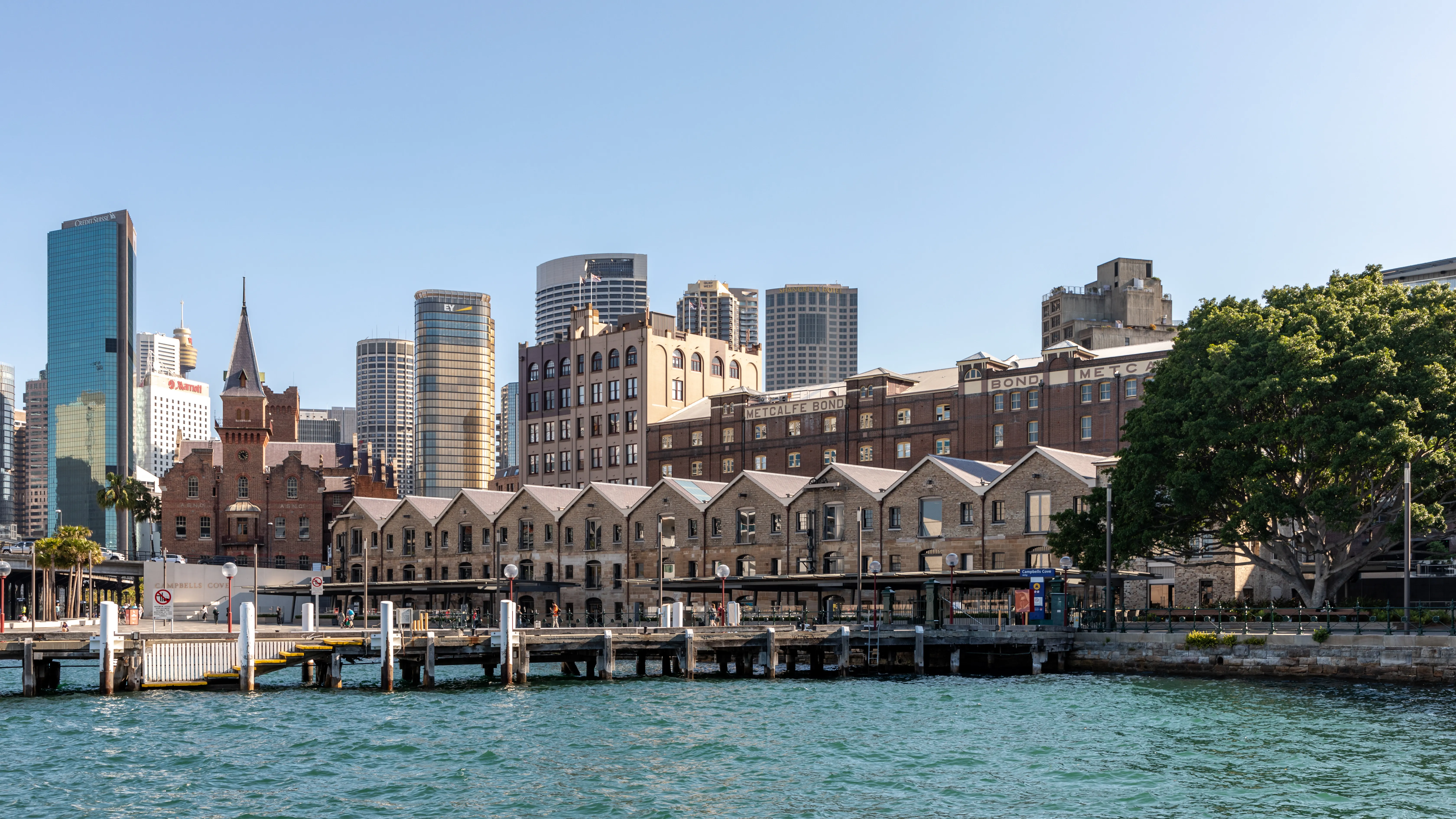
The Rocks Circuit (about 45 minutes on foot, easy with one steep optional climb) links the quarter's landmarks in a compact loop. Begin at Cadman's Cottage on the harbourside promenade — built in 1816 for the colony's coxswain, it is the oldest surviving house in inner Sydney and a good place to picture how close the original shoreline once ran. Walk into the lanes to the free Rocks Discovery Museum on Kendall Lane, housed in a restored 1850s sandstone warehouse, then thread through Nurses Walk and the Suez Canal — two of the narrowest surviving colonial alleys, so tight that the second earned its name from the way floodwater once "sewers-up" through it.
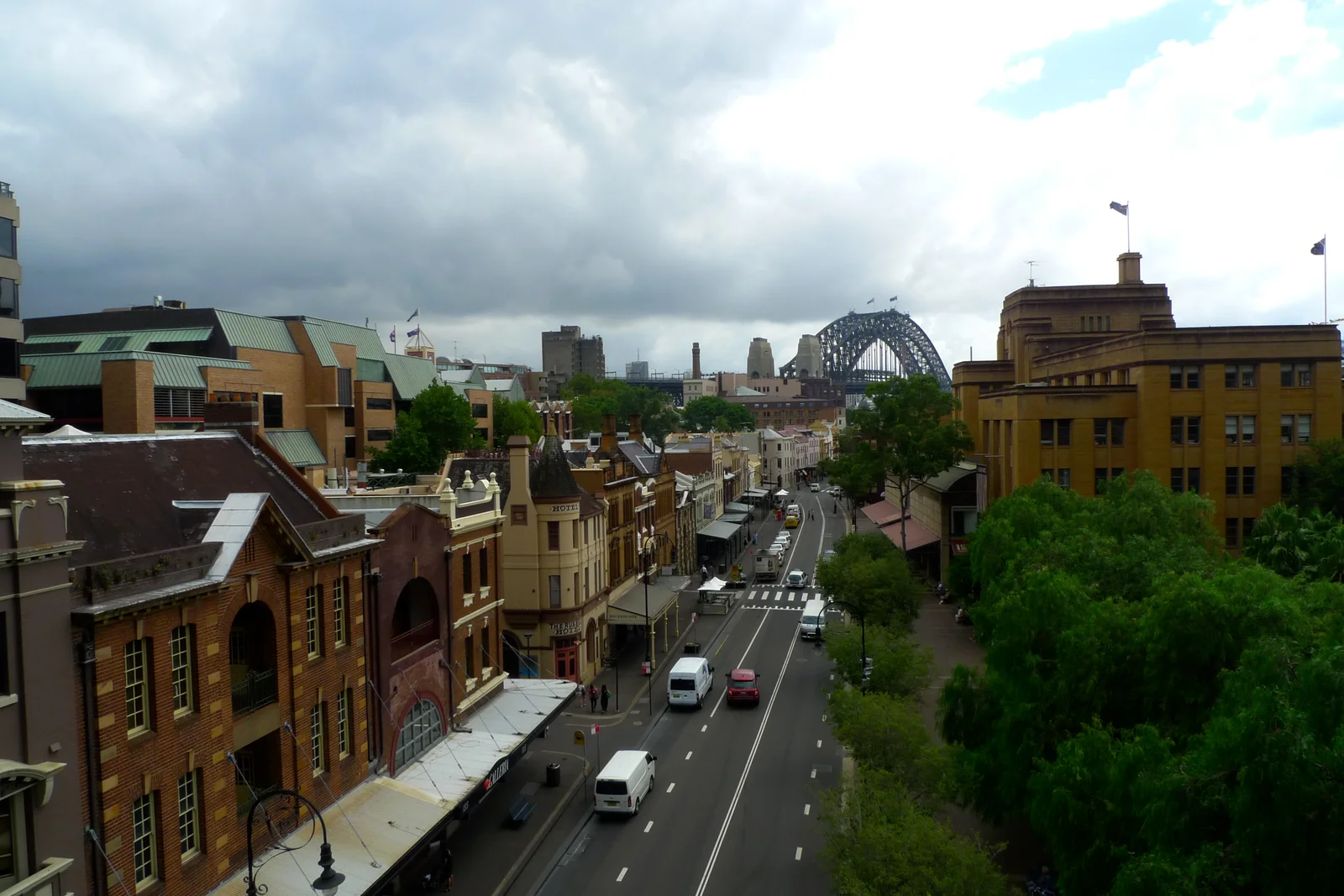
Climb George Street through the market arbour to the Susannah Place Museum on Gloucester Street, a terrace of four brick houses from 1844 with original interiors and a working corner shop, preserved by Museums of History NSW. Continue west to Foundation Park, where the excavated footings of demolished convict-era houses are displayed as an open-air archaeological site, then pass through the Argyle Cut — a sandstone road tunnel begun with convict picks in 1843 and deepened by council labour into the 1860s, its chisel marks still legible in the rock face. Finish by climbing to Observatory Hill for the highest green outlook over the harbour, or detour to the Hero of Waterloo Hotel (1843) on Lower Fort Street, one of several sandstone pubs whose competing claims to be Sydney's oldest are a story in themselves.
The Harbour Bridge approach walk (20 minutes each way): from the western lanes, follow Cumberland Street north to the Argyle Stairs and the BridgeClimb check-in at Number 3, then continue to the Pylon Lookout for views from 89 metres at the south-east pylon and, if you have booked, the full Sydney Harbour Bridge climb to the arch summit. For photographs, the best light falls in the early morning: golden sun rakes along the sandstone of the western lanes, while the framed view of the bridge from Dawes Point Park and the reflected silhouette of the Sydney Opera House across the cove both reward a photographer who arrives before the day-trip crowds.
Local Life
The Rocks keeps a small working residential population among its tourist infrastructure — an unusual quality for such a heavily visited precinct, and part of what saved it during the Green Bans. The Friday Rocks Foodie Market (roughly 9 AM–3 PM near the Argyle Centre) is where office workers and locals eat, distinct from the weekend artisan market aimed at visitors. For a drink with a view, the Glenmore Hotel rooftop on Cumberland Street looks straight down over the harbour and the bridge; arrive before 5 PM on Fridays and Saturdays to secure a terrace table. The Argyle, a bar and event space carved into the convict-built sandstone stores off the Cut, hosts live music inside a 19th-century vault, while the historic pubs — the Hero of Waterloo, the Fortune of War on George Street, and the Lord Nelson Brewery Hotel at the western edge — each brew or pour with the particular atmosphere that thick sandstone walls provide.
Culturally, the quarter is unusual for wearing its full history in public: the same lanes hold a penal-colony origin, a working-class Victorian slum, a plague ground, and a landmark of the modern heritage movement, all within a five-minute walk. Break from the historic circuit at First Fleet Park and Dawes Point Park for open grass on the foreshore, or duck into the galleries and designer-craft studios that have colonised the old bond stores along Playfair and Kendall Lanes. It is an easy afternoon to combine with the harbour icons on either side — the Sydney Opera House a ten-minute walk east around the cove, and, further out, a ferry or bus day at Bondi Beach.
The Rocks in Pictures
When to Visit
The Rocks is a public neighbourhood, accessible 24 hours. The Rocks Discovery Museum at 2–8 Kendall Lane is open daily 10 AM–5 PM (free entry). The Rocks Markets run Saturday and Sunday 10 AM–5 PM year-round, with the smaller Friday foodie market operating roughly 9 AM–3 PM. Susannah Place Museum opens for guided visits on selected days — check Museums of History NSW before you go, as entry is by timed tour. Ghost tours typically depart in the early evening from around 6:30 PM Friday through Sunday (bookings essential). Café and restaurant trade peaks at lunch, though several waterfront restaurants open for breakfast from 7 AM, and the pubs run from late morning until late. For unhurried architecture photography, the quarter is quietest on weekday mornings before the tour groups arrive from Circular Quay.
Admission and Costs
Walking The Rocks is free: the lanes, the harbourside promenade, Foundation Park, and the Rocks Discovery Museum all cost nothing. A free walking tour on a tipping model departs from the visitor area daily, typically at 10:30 AM and 2:30 PM, covering the main historic circuit in about 90 minutes. Susannah Place Museum guided entry runs about A$12–15 ($8–10) per adult. Ghost tours cost roughly A$45–55 ($30–37) per person for around 90 minutes. A private historical guide for a custom two-hour walk for up to six people ranges A$250–400 ($165–265). The Rocks Markets are free to enter; budget for a coffee, a maker's print, or a sourdough from the food stalls. Prices are indicative and vary by operator and season; book premium ghost and private tours ahead on weekends.
The Case for a Guide
The Rocks is handsome enough to enjoy on its own, but almost all of its meaning is invisible without someone to read the stone for you. A knowledgeable guide turns a pretty grid of sandstone lanes into the layered story of a colony that began here, nearly demolished itself twice, and survived by accident and by protest.
- The founding narrative: from the First Fleet landing and the Tank Stream to the Gadigal country it displaced, a guide anchors the abstract "1788" to the actual ground beneath your feet
- Reading the layers: guides decode which walls are original Georgian bond store, which are Victorian rebuild, and which are 1970s reconstruction — a distinction most visitors never notice
- The hidden lanes: Nurses Walk, the Suez Canal, and the excavated footings at Foundation Park only make sense with the demolished streetscape narrated back over them
- Plague and Green Bans: the 1900 resumption and the 1970s union bans are the two events that shaped everything you see, and both are stories rather than plaques
- Efficient routing: a guide links Cadman's Cottage, the museum, Susannah Place, the Argyle Cut, and Observatory Hill into one loop, so you see the quarter without doubling back up the hill
Tips for Visitors
Weekend markets vs weekday exploration: The Rocks Markets (Fri–Sun) bring craft and food stalls that crowd the lanes and make unhurried architectural exploration difficult. For walking the convict-built streetscapes and reading historical plaques without interruption, Tuesday and Wednesday mornings are ideal — the buildings are identical but the atmosphere is completely different.
Start at the visitor area: pick up the free self-guided walking-tour map before you begin, particularly for the pamphlet that identifies which specific buildings are original and which are reconstructed. Fifteen minutes here saves an hour of guessing.
Wear grippy shoes: the western half of the quarter is built on a slope of sandstone and cobbles, with the Argyle Stairs and the Observatory Hill approach both steep and slick after rain. Keep to the flat George Street spine and the harbourside promenade if you are pushing a pram or using a wheelchair.
Combine with the harbour icons: The Rocks sits a flat ten-minute walk from both the Sydney Opera House and the base of the Sydney Harbour Bridge, so pair it with a bridge climb or an Opera House tour rather than treating it as a separate trip. All three radiate from Circular Quay.
Frequently Asked Questions
What is The Rocks in Sydney?
The Rocks is the oldest surviving district of Sydney and of European Australia, occupying the western end of Circular Quay at the base of the Sydney Harbour Bridge. When the British First Fleet arrived in January 1788, this sandstone promontory above the Tank Stream was where the first tents went up; within years it had become a rough and densely populated neighbourhood of convicts, sailors, and freed settlers. Several Georgian warehouses and terraces from the early to mid-1800s survive alongside later Victorian buildings, making The Rocks the only place in Australia where you can walk a streetscape with direct physical continuity to the colonial era.
Are the ghost tours of The Rocks worth doing?
The Rocks ghost tours run on weekend evenings and approach the district's darker history — the 1900 bubonic plague outbreak and the clearances that followed, the convict-era executions, and the violent gangs of the larrikin era — through a combination of documented history and atmospheric storytelling. Whether or not you believe in ghosts, the tours are one of the best ways to hear stories about this part of Sydney that are not covered in daytime walking tours. The evening setting and lantern light add genuine atmosphere to the narrow sandstone lanes. Book ahead on weekends, when the tours fill quickly.
When does The Rocks Market operate?
The Rocks Markets operate every Saturday and Sunday from approximately 10 AM to 5 PM, occupying the shaded arbour on George Street and extending into Playfair Street. The market focuses on Australian artisan goods, including leather, jewellery, ceramics, and food produce. Saturday tends to have more vendor stalls; Sunday draws a slightly larger crowd. The market has operated in this location since 1971, making it one of Sydney's longest-running outdoor markets. Arrive before noon on Sundays to avoid the largest crowds at the peak early afternoon period.
How do you get to The Rocks?
The Rocks sits immediately north-west of Circular Quay, the transport hub where Sydney's train, ferry, light rail, and bus networks converge. From Circular Quay station it is a flat five-minute walk north along George Street or the harbourside promenade into the heart of the precinct; a contactless bank card or Opal tap covers the fare on any mode. The district is an easy extension of a harbour day that also takes in the Sydney Opera House on the eastern arm of the cove and the Sydney Harbour Bridge overhead, so most visitors arrive on foot from one or the other rather than by dedicated transport.
Is The Rocks suitable for wheelchairs and families?
The main flat spine along George Street, the market arbour, and the harbourside promenade past Campbell's Cove are level and pram- and wheelchair-friendly, and the free Rocks Discovery Museum is accessible. The historic character of the quarter, however, means the western lanes climb steeply — the Argyle Stairs, Foundation Park, and the approach to Observatory Hill involve stone steps and cobbled inclines that are difficult with a wheelchair or stroller. Families do well here — the free, hands-on museum, the food stalls of the weekend markets, and the open harbour foreshore all give children room to move between historic stops.