
Engineering Facts
Namsan Tower's engineering combines broadcast infrastructure with public access in a relatively unusual configuration for its era:
- Structural system: The tower uses a concrete core shaft with external steel frame support; the observation bulge near the crown is cantilevered from the central shaft rather than supported by columns, giving the characteristic widened silhouette
- Foundation: Built directly into Namsan's granite summit; the mountain's bedrock provides exceptional stability compared to the alluvial river-plain geology of most of central Seoul
- Broadcast function: The tower remains operational as a broadcast transmission facility — antennas on the upper mast still transmit Seoul's major television and FM radio networks; the observation floors are built around rather than instead of this primary function
- Seismic rating: Designed to withstand significant seismic events; the Korean peninsula experiences minor seismic activity and the tower's 1969 design incorporated contemporary earthquake engineering standards
- Colour illumination: The nightly colour-change lighting system uses programmable LED arrays installed in the 2005 renovation; the air quality colour coding (blue = clean air, red = fine dust warning, green = general notification) became an unofficial Seoul meteorological institution recognised without formal promotion
Observation Points
The tower offers multiple distinct viewpoints at different elevations:
Ground-level plaza (243m above sea level):
- Padlock installation panels on chain-link fencing around the tower base
- Hanbok photo rental booths
- Cafe terraces with northern hillside views toward Bukchon Hanok Village and Bugaksan mountain
- Bongsudae signal tower ruins — a 5-minute walk from the main plaza
Observatory entrance levels (accessed by elevator within the tower):
- Interior observation floor with floor-to-ceiling glazing at approximately 450m above sea level
- 360° exterior deck immediately above — the highest publicly accessible open-air point; wind exposure at summit level is significant and temperatures drop 3–5°C versus the city floor
Dining levels:
- N Grill rotating restaurant at crown level — full rotation cycle approximately 48 minutes; reservations required
- Cafe N cloud at observatory level
Namsan trails (forested slopes):
- Palgakjeong Pavilion viewpoint on the eastern slope — Han River and Gangnam views with less tourist density than the summit
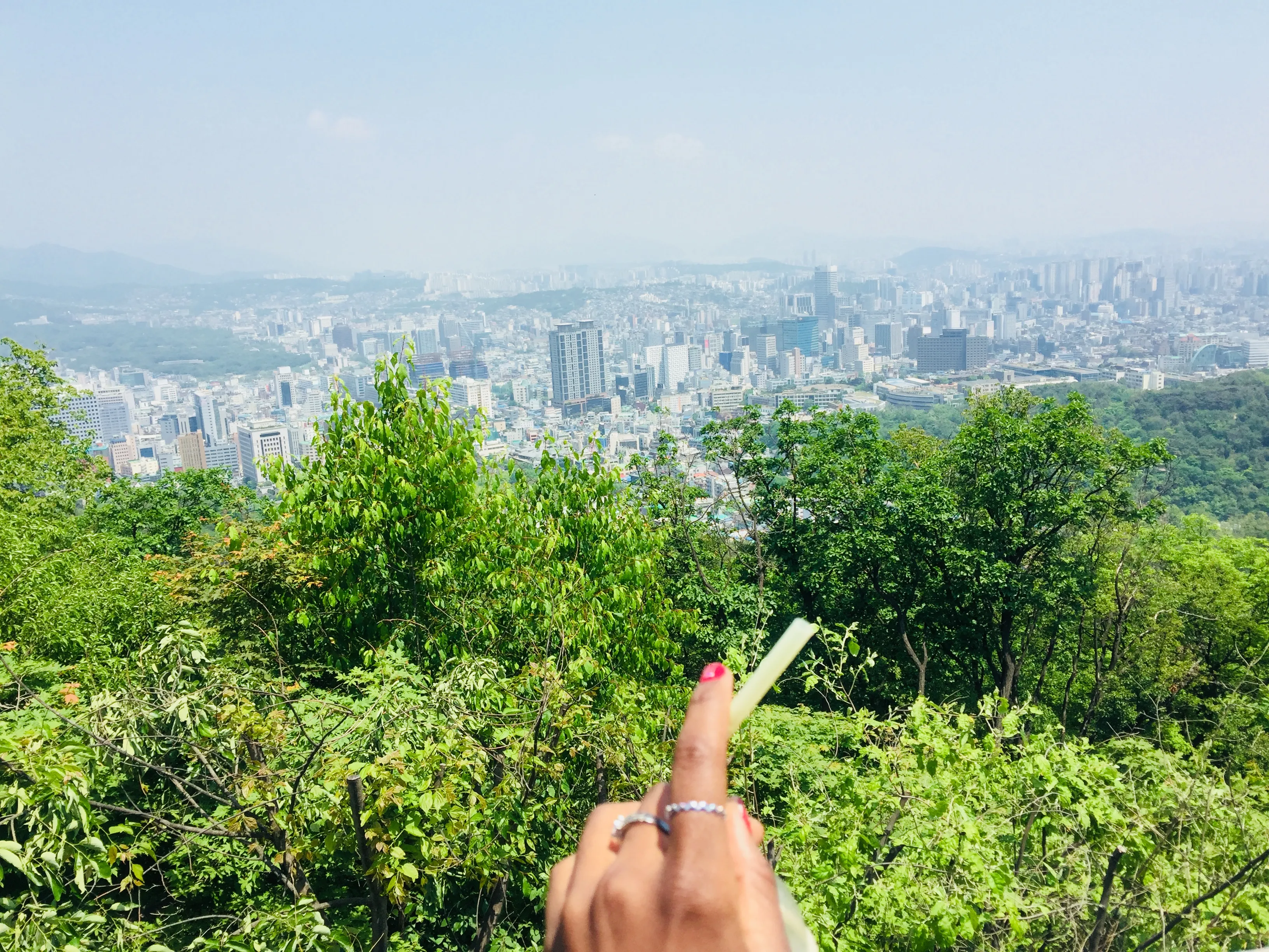
- Sunset viewpoint on the western ridge — the best position for photographing the tower itself against the city during golden hour, rather than from the tower
When to Visit
Cable car: Daily 10 AM – 11 PM (last ascent); extended hours on weekends and public holidays.
Observatory: Sunday–Thursday 10 AM – 10 PM; Friday–Saturday 10 AM – 11 PM.
Namsan hiking trails: Accessible 24 hours; the trail from Myeongdong base takes approximately 35–45 minutes.
Best times:
- Clear autumn days (October–November): Maximum visibility; the mountain foliage adds colour to the surrounding slopes
- Sunset and evening: The Han River reflects the fading light and the city lights build gradually; arrive 30 minutes before sunset for the full transition
- Avoid: Weekends between 2 PM and 7 PM when cable car queues can exceed 45 minutes
Admission and Costs
Cable car: ₩13,000 round trip ($9.60) | ₩8,000 one way ($5.90). Free for children under 4.
Observatory admission: ₩21,000 ($15.50) adults | ₩14,000 ($10.35) children (ages 3–12). Note: cable car and observatory are sold separately.
Combined cable car + observatory package: ₩33,000 (~$24.40) — slight discount versus buying separately.
N Grill restaurant: Set menus from ₩65,000 (~$48) per person — reservation strongly recommended; the observatory admission is included with dining.
Hiking: Free — no admission charge for the Namsan trails; only the tower observatory requires payment.
The Case for a Guide
Namsan Tower is navigable independently and most visitors do so successfully. A guide adds specific value for visitors who want more than the view:
- Namsan historical context: The guide connects the tower's modern function to the ancient Bongsudae signal beacon system on the same summit — explaining how the mountain has served as Seoul's communications high point for over 600 years across completely different technologies
- City orientation: Looking out across the Seoul basin, the guide identifies the key landmarks visible from the deck — tracing the palace axis from Gwanghwamun through to Gyeongbokgung, locating the Han River's crossing points, and explaining why the city's high-density development concentrated in Gangnam (south of the river) from the 1970s onward
- Air quality education: The guide explains the fine dust problem — its origins in Chinese industrial output combined with Korean domestic sources, its seasonal pattern, and the way it has influenced outdoor culture and architecture — context that turns a weather phenomenon into a contemporary environmental story
- Namsan ecology walk: Combining a guided forest trail ascent with tower observation adds the mountain's ecology and history of use (the Joseon-era signal beacons, the Japanese colonial-era shrine that formerly occupied the summit) to the purely observational tower visit
- Evening Seoul mapping: For visitors early in their trip, a guided sunset tower visit that names and locates every visible district provides a spatial framework for understanding the neighbourhoods they will visit in the days ahead
Tips for Visitors
Visit for sunset: The tower is compelling at any hour, but arriving 30–40 minutes before sunset and staying through the full darkness transition captures the city's transformation from golden afternoon to neon-lit night — the most atmospheric experience the tower offers.
Hike up, cable car down: The forest trail ascent takes about 40 minutes and provides a genuinely pleasant city-forest walk; the cable car descent saves time and knees and offers an aerial view of the Myeongdong basin below.
Check air quality first: Seoul experiences periodic fine dust (misemeonji) events where visibility drops to under 5 kilometres — the tower's colour illumination (red = poor air) is the immediate indicator. Korean air quality apps (AirVisual, Korea AirKorea) give precise PM2.5 readings before you commit to the journey up.
Padlock logistics: If participating in the padlock tradition, bring your own lock from below — locks sold at the summit carry significant tourist markup. A standard padlock with a marker pen message costs a fraction of the branded summit options.
Combine with Myeongdong: The cable car base is a 10-minute walk from Myeongdong's street food and shopping district — an evening at Namsan Tower followed by late-night tteokbokki and hotteok (sweet pancakes) in Myeongdong makes a natural Seoul evening.
Frequently Asked Questions
What is Namsan Tower and why is it important to Seoul?
Namsan Tower — officially N Seoul Tower, colloquially called either Namsan Tower or Seoul Tower — was built in 1969 as a broadcast transmission facility for Seoul's television and radio networks, making use of the natural elevation advantage of Namsan mountain in the centre of the Seoul basin. It opened to the public in 1980. The tower itself stands 236 metres tall, but because it sits on the 243-metre summit of Namsan mountain, the observation deck reaches 479 metres above sea level — placing it at a vantage point from which the entire Seoul metropolitan basin is visible in every direction. Its significance to Seoul is simultaneously practical (the best elevated viewpoint accessible to the public from the city centre) and symbolic: the tower's outline has become the most widely recognised element of the Seoul skyline, visible from dozens of districts and used as a navigational landmark by residents across the basin.
What is the padlock tradition at Namsan Tower?
The padlock tradition — attaching a lock inscribed with a couple's names or a personal declaration to a fence railing at the tower base — began in the early 2000s and is believed to have been popularised initially by Korean drama and film depictions of Namsan as a romantic setting. The practice spread rapidly and the tower now hosts hundreds of thousands of locks attached to purpose-built chain-link panels installed around the observation deck fence perimeter and on the adjacent hillside railings. The locks range from small brass padlocks with handwritten marker pen dedications to elaborate custom-engraved pieces. Seoul has periodically discussed removing them for structural and aesthetic reasons, but the tradition has become too embedded in the tower's identity to reverse; the installation of dedicated lock panels represents an accommodation with the phenomenon rather than a management of it.
How do you get to Namsan Tower?
Three routes reach the tower summit. The cable car runs from a base station in the Myeongdong area (a 10-minute walk from Myeongdong subway station, Line 4) up the western face of Namsan in approximately 5 minutes; it operates from 10 AM daily and costs ₩13,000 round trip ($9.60). The hiking trail ascends from the same Myeongdong base via a forested path in approximately 40 minutes at a comfortable pace; the trail is well-maintained with signposting in English. A public bus (Namsan Sunhwan Shuttle) runs on a circular route connecting Myeongdong and the Hanam-dong area to the summit, though schedules vary seasonally. Taxis can access the summit road but must use the one-way loop rather than stopping directly at the tower entrance.