Getting Around Seoul: A Practical Transport Guide
How to navigate Seoul's transport — the vast subway, buses, and taxis tied together by a single T-money card, plus airport transfers from Incheon.
Read the full guideUpdated · 9 min read
Getting around Seoul comes down to one card and one app: a rechargeable T-money card that works on every subway, bus, and taxi, and a Korean mapping app — Naver Map or KakaoMap, not Google — that routes you accurately. The subway is world-class, clean, and cheap, the buses fill the gaps, and many central neighbourhoods are a short, walkable hop apart.
Seoul moves a metropolitan population of some 25 million with one of the best transit systems on the planet, and for a visitor the good news is that mastering it takes about fifteen minutes. The system is cheap, punctual, spotless, and signed in English, and it is tied together by a single payment card that removes almost all friction. The one genuine trap is navigation: the mapping app you rely on at home does not work well here. This guide walks through how to pay, plan, and move around Seoul, the dynamic capital of South Korea, from the airport train to the last-mile walk.
What is the T-money card and why do you need one?
T-money is Seoul's universal rechargeable transit card, tapped on entry and exit across the subway, city buses, and most taxis, plus convenience stores. It gives cheaper fares than single tickets, enables free timed transfers between modes, and removes the need to buy tickets at all. Pick one up and load it at any station machine or convenience store the moment you arrive.
The T-money card is the first thing to sort out. It is a slim contactless card, sold for a small fee at any subway station machine, ticket office, or the ubiquitous convenience stores (CU, GS25, 7-Eleven), and topped up with cash at the same places. Once loaded, you simply tap in and tap out — on the subway, on buses, and even in many taxis — and the fare, discounted below the single-ticket price, is deducted automatically. Its real magic is the integrated transfer system: change between subway and bus within 30 minutes and the transfer is free or nearly so, provided you tap out each time. Keep the card topped up, always tap both on entry and exit, and you never think about tickets again for the whole trip.
How is the Seoul subway structured?
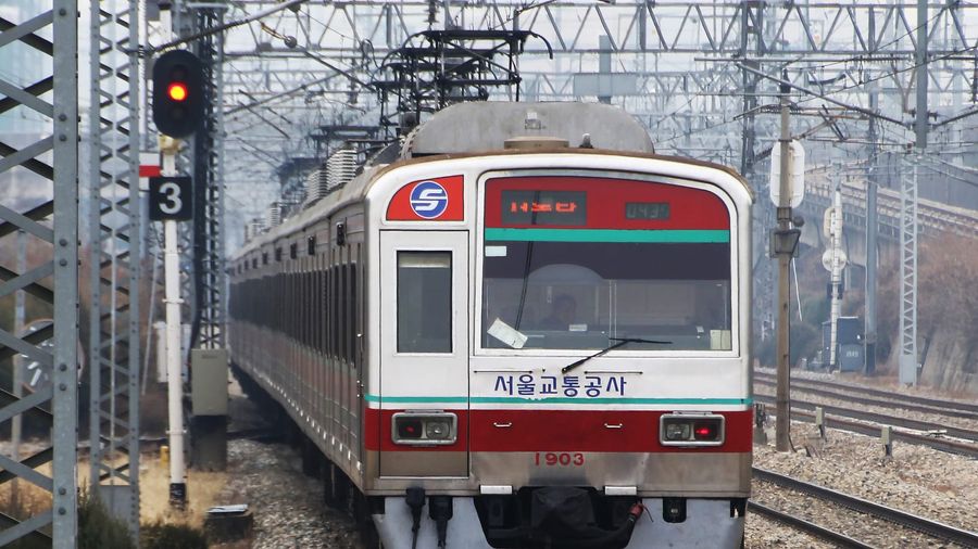
The Seoul Metropolitan Subway is one of the largest networks in the world, with over 20 numbered, colour-coded lines fanning out from the centre. Lines 1 to 4 cover most of the tourist core, stations are numbered for easy navigation, and trains are frequent, air-conditioned, and signed in English. It is the fastest and cheapest way across the city.
The subway is the backbone of any Seoul visit. The network is enormous — more than 20 lines reaching deep into the surrounding province — but the parts a visitor needs are simple. Each line has both a number and a colour, each station carries a three-digit code, and English appears on every sign, map, and announcement. For sightseeing, Lines 1 through 4 and the circular Line 2 cover most of what you will want, from the palaces and old quarters north of the Han River to the shopping and nightlife districts south of it. Trains run frequently from around 5.30 AM to midnight, fares are low and distance-based, and the one habit to build is watching for the right platform direction and the numbered exit — stations often have a dozen exits, and coming up the wrong one can leave you a long walk from where you meant to be.
Which navigation app should you use in Seoul?
Use Naver Map or KakaoMap, not Google Maps, which is crippled in South Korea by mapping-data restrictions. Both Korean apps offer full English interfaces, accurate subway and bus routing with real-time arrivals, and reliable walking directions. Downloading one before you arrive is the single most important preparation for getting around Seoul.
This is the mistake that trips up almost every first-time visitor: Google Maps does not give proper transit or walking directions in South Korea, because national security rules restrict the export of detailed mapping data. Relying on it leaves you stranded. The solution is to download a Korean app instead — Naver Map or KakaoMap — both of which have English-language modes, route accurately across subway, bus, and on foot, show real-time arrivals, and even tell you which subway car to board for the fastest transfer or exit. They are what Seoulites actually use. Set one up before you land, search in English or by pasting Korean place names, and the city becomes effortless to navigate; skip this step and the excellent transit system becomes far harder to use than it should be.
When should you take a bus or a taxi?
Buses reach corners the subway misses and are cheap with T-money, but the route numbers and Korean-only stops make them harder for visitors — lean on a mapping app to use them. Taxis are plentiful, metered, honest, and reasonably priced, best for late nights after the subway closes, heavy luggage, or short group trips.
Once the subway and card are sorted, buses and taxis fill the gaps. City buses are colour-coded by function — blue for main arterials, green for local feeders, red for longer suburban runs — and cost little with a T-money tap, but the stops and on-board announcements skew Korean, so a mapping app is essential to know when to get off. For most visitors they are a supplement to the subway rather than a first choice. Taxis, by contrast, are easy: they are numerous, metered, cheap by developed-world standards, and the KakaoTaxi app (linked to KakaoMap) lets you hail and pay without speaking Korean. They come into their own after the subway shuts around midnight, when you are hauling luggage, or when a small group can split the modest fare. Have your destination ready in Korean on your phone to show the driver.
How do you get from Incheon Airport into the city?
The AREX airport railroad is the standard link from Incheon: the express reaches Seoul Station in about 43 minutes, the cheaper all-stop commuter train in around an hour on T-money. Limousine buses run direct to hotel districts, useful with luggage, while taxis are convenient but the priciest option for the hour-long trip.
Most visitors arrive at Incheon International Airport, about an hour west of the city, and the transfer is well organised.
| Option | Time to central Seoul | Notes |
|---|---|---|
| AREX express train | ~43 min to Seoul Station | Fixed fare, fastest rail option, reserved seating |
| AREX commuter train | ~60 min, all stops | Cheapest; pay with T-money, no reservation |
| Limousine bus | 60–90 min | Direct to hotel districts, good for heavy luggage |
| Taxi | ~60 min (traffic-dependent) | Most convenient door-to-door, most expensive |
For most travellers the AREX train is the sweet spot — fast, cheap, and immune to the road traffic — with the limousine bus a strong alternative if your hotel sits far from a station and you are carrying bags. Buy or top up your T-money at the airport station before you board so the rest of the trip is seamless.
When is walking better than the train?
Seoul's central sights cluster tightly enough that walking often beats the subway for short hops, especially around the historic core. The palaces, hanok village, and old quarters north of the river sit within a compact, strollable zone, and covering them on foot reveals the street life that the subway skips beneath.
For all the excellence of the transit system, the most rewarding way to see central Seoul is often on foot. The historic heart is compact: Gyeongbokgung Palace, the grand Joseon-dynasty royal palace, sits a short, pleasant walk from Bukchon Hanok Village, the hillside quarter of restored traditional courtyard houses, with the shops and tea houses of Insadong and Samcheong-dong strung between them. Hopping one subway stop here can actually take longer than walking, once you factor in the deep stations and long exits. The city's other great landmark, Namsan Tower on its central peak, is reached by a walking trail or cable car for the panoramic reward at the top. Use a mapping app to gauge when a walk beats the train, and you will both save time and see far more of the city between the sights.
Related Guides
- Planning a Seoul Trip — build the getting-around basics into a full first-visit itinerary
- Getting Around Tokyo: A Practical Transport Guide — how a neighbouring Asian megacity runs its transit differently
- Tokyo vs Osaka: Which City Should You Visit? — comparing transit-rich Japanese cities for a wider East Asia trip
Seoul's transport rewards a few minutes of setup. Buy and load a T-money card, download Naver Map or KakaoMap in place of Google, and learn to read the numbered subway lines and station exits, and one of the world's densest cities shrinks to an easy, cheap, walkable scale. Sort those three things on arrival and you will spend your visit exploring rather than puzzling over how to get anywhere.
Frequently Asked Questions
What is a T-money card and do I need one in Seoul?
T-money is a rechargeable tap-to-pay card accepted on every Seoul subway line, city bus, and most taxis, plus convenience stores. It is close to essential — it gives discounted fares, enables free transfers between subway and bus, and saves buying single tickets. Buy and top one up at any station machine or convenience store on arrival.
How do I get from Incheon Airport to central Seoul?
The AREX airport railroad is the standard choice. The express train reaches Seoul Station in about 43 minutes, while the cheaper all-stop commuter train takes around an hour and accepts T-money. Limousine buses run directly to hotel districts, and taxis are convenient but far pricier for the roughly one-hour trip.
Is Google Maps reliable for getting around Seoul?
No — Google Maps has limited transit and walking directions in South Korea because of local mapping restrictions. Use Naver Map or KakaoMap instead; both offer English interfaces, accurate subway and bus routing, real-time arrivals, and reliable walking navigation, and are what locals actually use.
Is the Seoul subway easy for non-Korean speakers?
Yes. Lines are numbered and colour-coded, every station has a number, and signage and announcements include English. Stations show exit numbers that maps reference directly, so following Naver Map or KakaoMap from platform to street exit is straightforward even without any Korean.