
Stavanger timeline
-
Battle of Hafrsfjord unites Norway
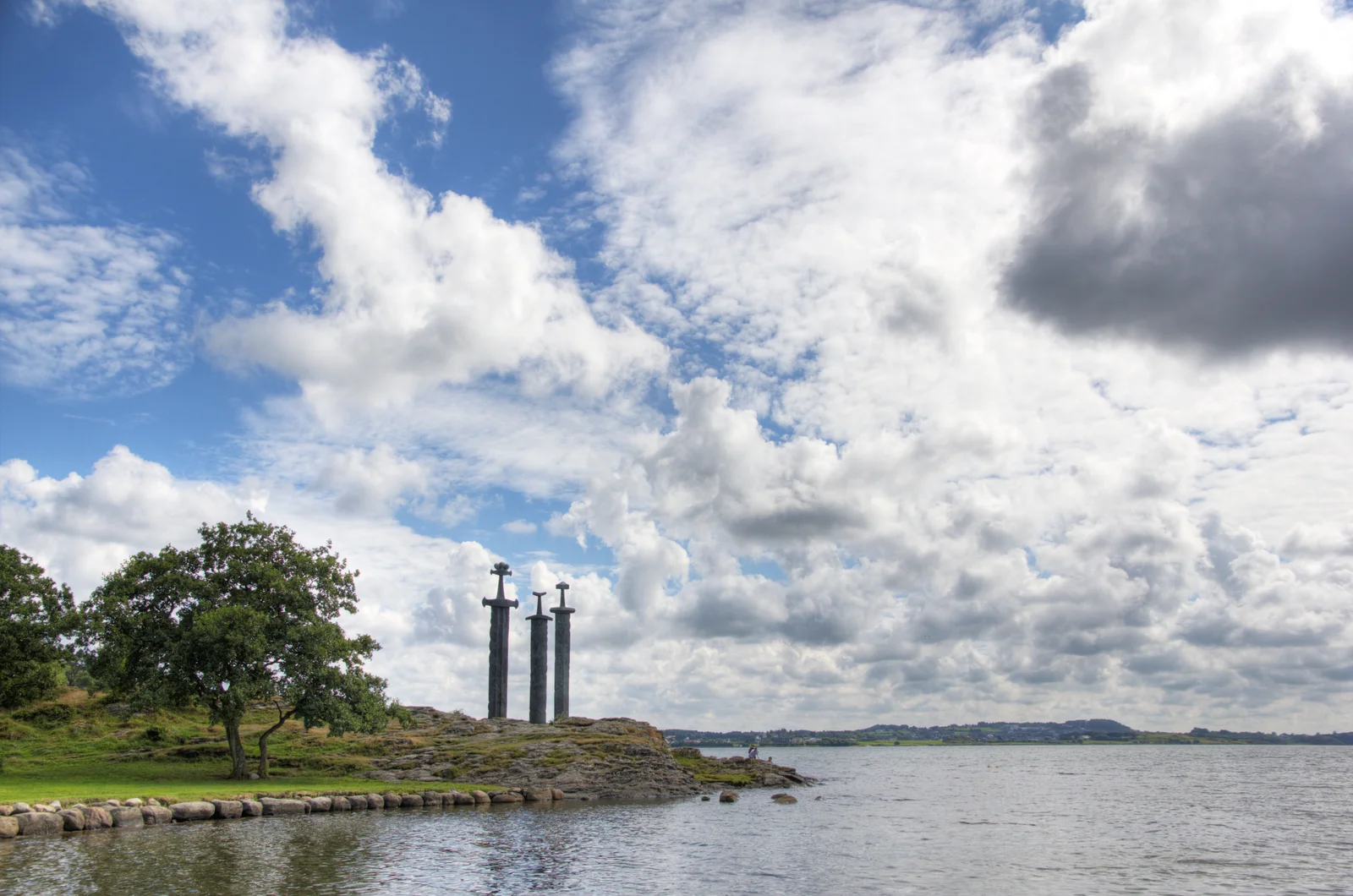
Harald Fairhair's victory in the fjord just outside today's city is remembered as the unification of Norway, marked by the Swords in Rock monument.
-
Cathedral city founded
Stavanger Cathedral was established under Bishop Reinald of Winchester, the founding date the city still counts from.
-
Canning boom feeds the city
Herring and sardine canneries lined the harbour, an era preserved today in the Norwegian Canning Museum in Gamle Stavanger.
-
Ekofisk oil discovery
The North Sea oil find turned Stavanger into Norway's energy capital and reshaped its economy within a generation.
-
Ryfast tunnel opens
The subsea road link shortened journeys between the city and Ryfylke's fjord country, including routes toward Preikestolen.
Cited city facts
Key facts for visiting Stavanger
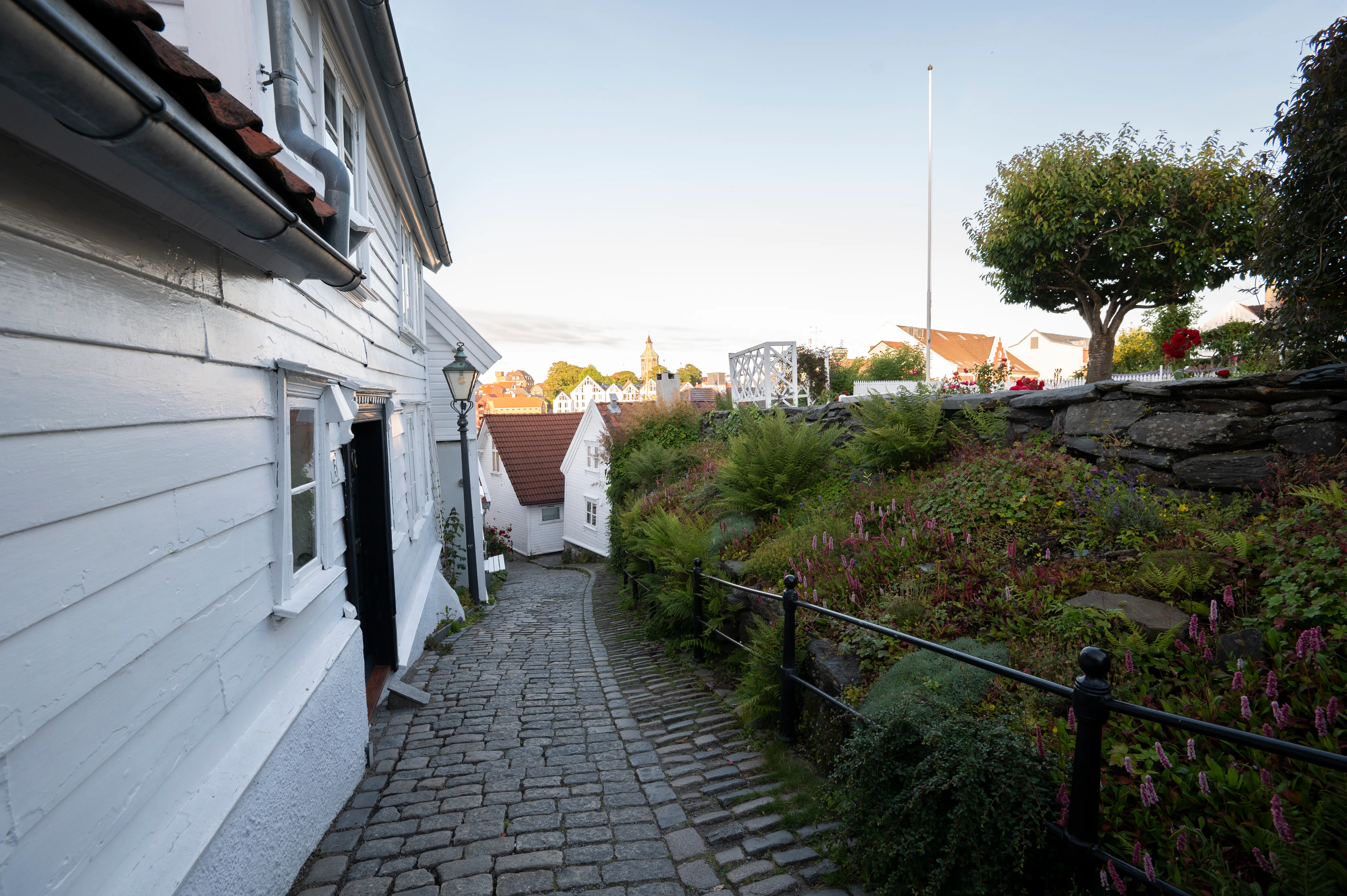
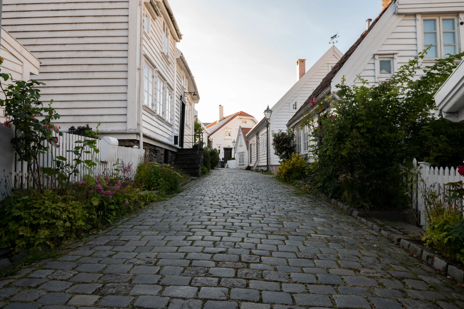
Stavanger's Gamle Stavanger (Old Stavanger) contains 173 white wooden houses, the best-preserved wooden town in Scandinavia
Built in the 18th and early 19th centuries by sea merchants and craftsmen, Gamle Stavanger survived the great fires that destroyed most Norwegian wooden towns because its residents formed one of Norway's earliest volunteer fire brigades. The houses are all still lived in, making it a working heritage neighbourhood rather than a museum piece
Norway struck oil 3.5 km below the North Sea floor on 23 December 1969, transforming the country's economy
The Ekofisk discovery by Phillips Petroleum changed Norway more profoundly than any event since Viking expansion — per-capita income grew from below the European average to among the world's highest within two decades, funding a welfare state, infrastructure programme, and a sovereign wealth fund whose story is told in full at Stavanger's own Norwegian Petroleum Museum
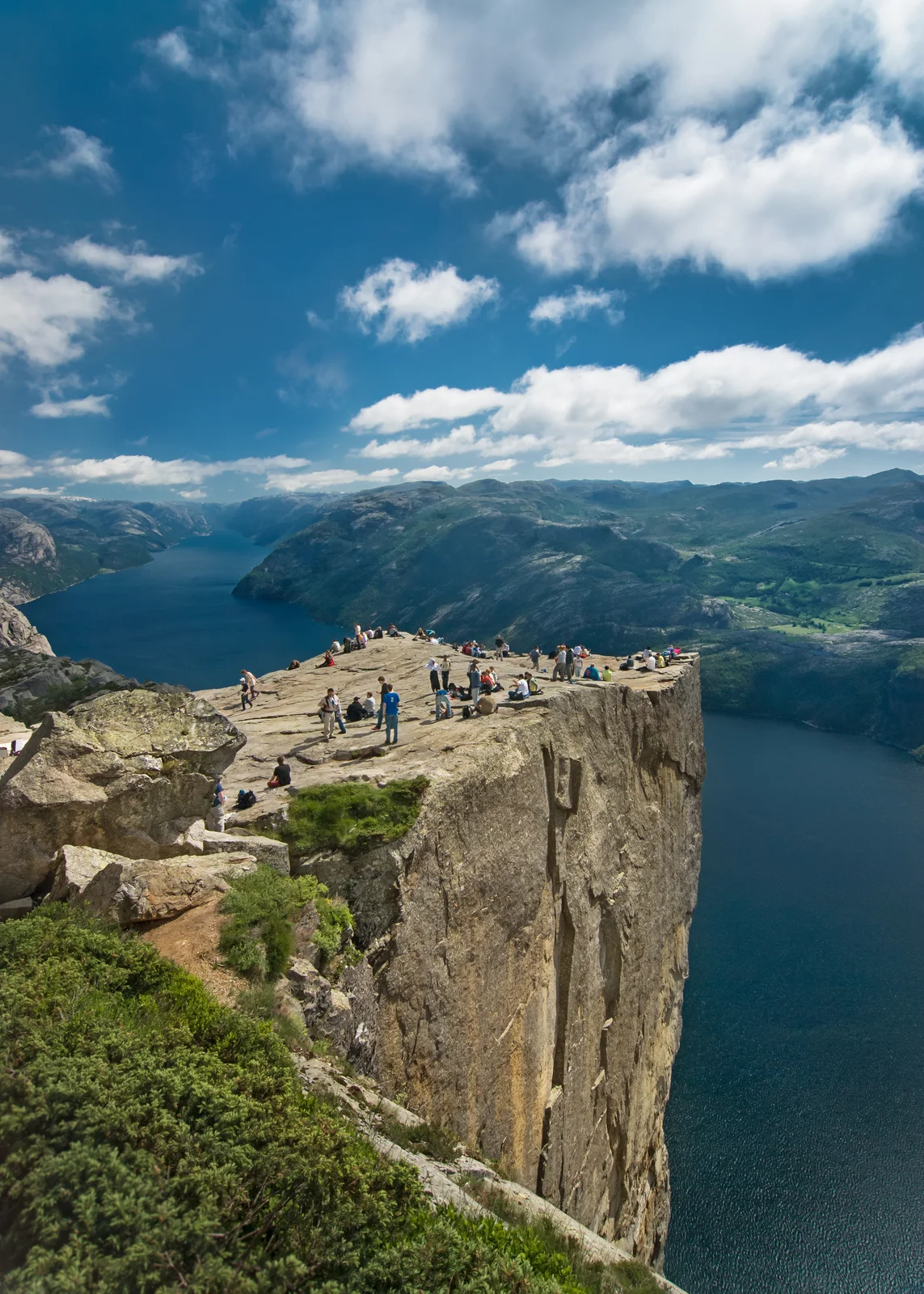
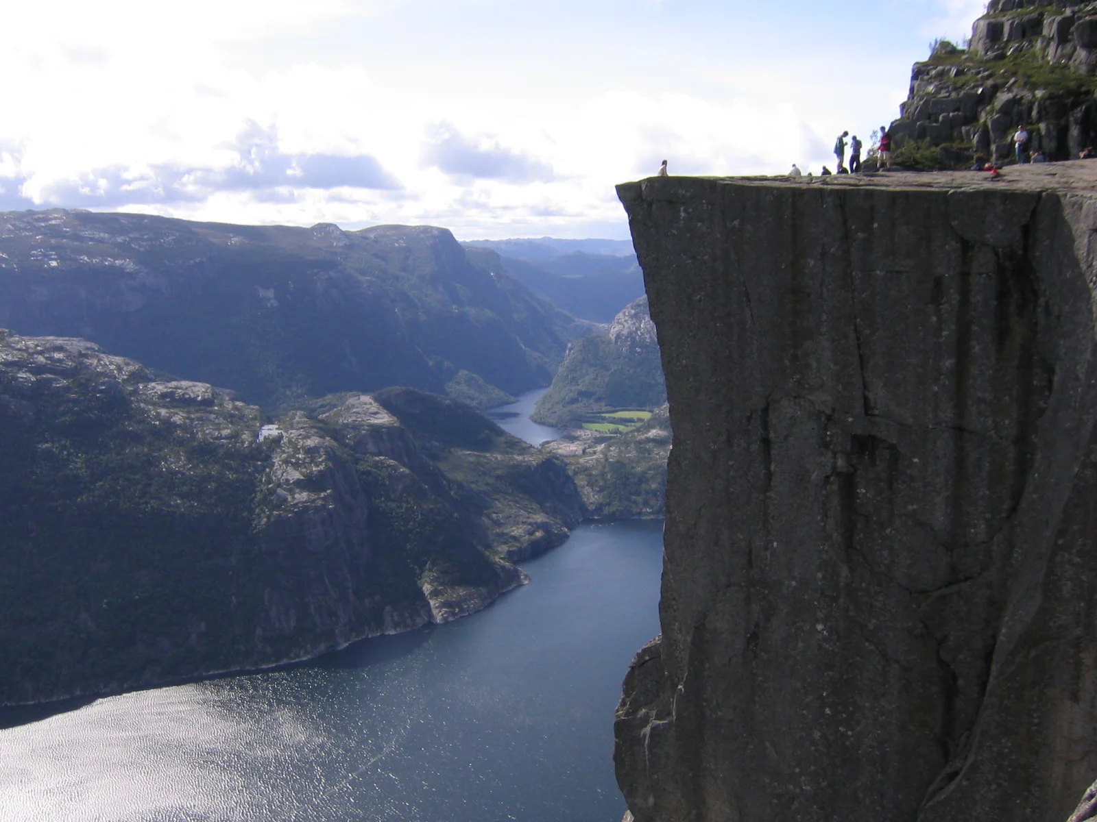
Pulpit Rock (Preikestolen) plateau is a near-perfect natural rectangle roughly 25 by 25 metres
The geometric precision of the cliff's flat top — 604 metres above Lysefjord — is the result of freeze-thaw fracturing of the granite along near-parallel joint planes during the last Ice Age, roughly 10,000 years ago. Geologists expect the entire block will eventually fracture away from the cliff face, though the timescale is measured in millennia
Harald Fairhair's victory at the Battle of Hafrsfjord in c.872 CE united Norway for the first time
The battle was fought in the fjord now occupied by Stavanger's western suburbs — the three towering bronze swords of the Sverd i fjell monument mark the spot — making the Stavanger region the birthplace of the Norwegian nation and the starting point of the Viking Age's most politically consequential chapter
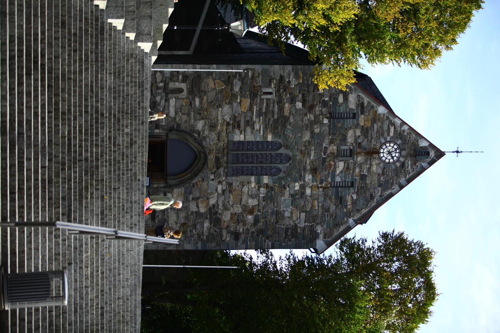
Stavanger Cathedral has held services continuously since about 1125, making it Norway's oldest cathedral still in use
The city traces its founding to the establishment of the bishopric and the consecration of the cathedral around 1125, when Bishop Reinald reputedly brought the relics of Saint Swithun from Winchester. The Romanesque nave and later Gothic chancel make the Domkirke the anchor of Stavanger's medieval identity, centuries before oil ever entered the story
Stavanger is Norway's energy capital, home to Equinor's headquarters and the national offshore regulators
Equinor — Norway's largest company and the operator of much of the North Sea — is headquartered at Forus on Stavanger's southern edge, alongside the Norwegian Offshore Directorate and the Petroleum Safety Authority. The city hosts the biennial ONS energy conference and, before oil, was Norway's sardine-canning capital, a history preserved at the Norwegian Canning Museum in Gamle Stavanger
Source: tour-guide.com — Free to cite with attribution
Things to see
What are the top attractions in Stavanger?
- Preikestolen (Pulpit Rock) — 604-metre cliff plateau above Lysefjord; 3.8 km hike each way, best done with a guide who times the departure for sunrise
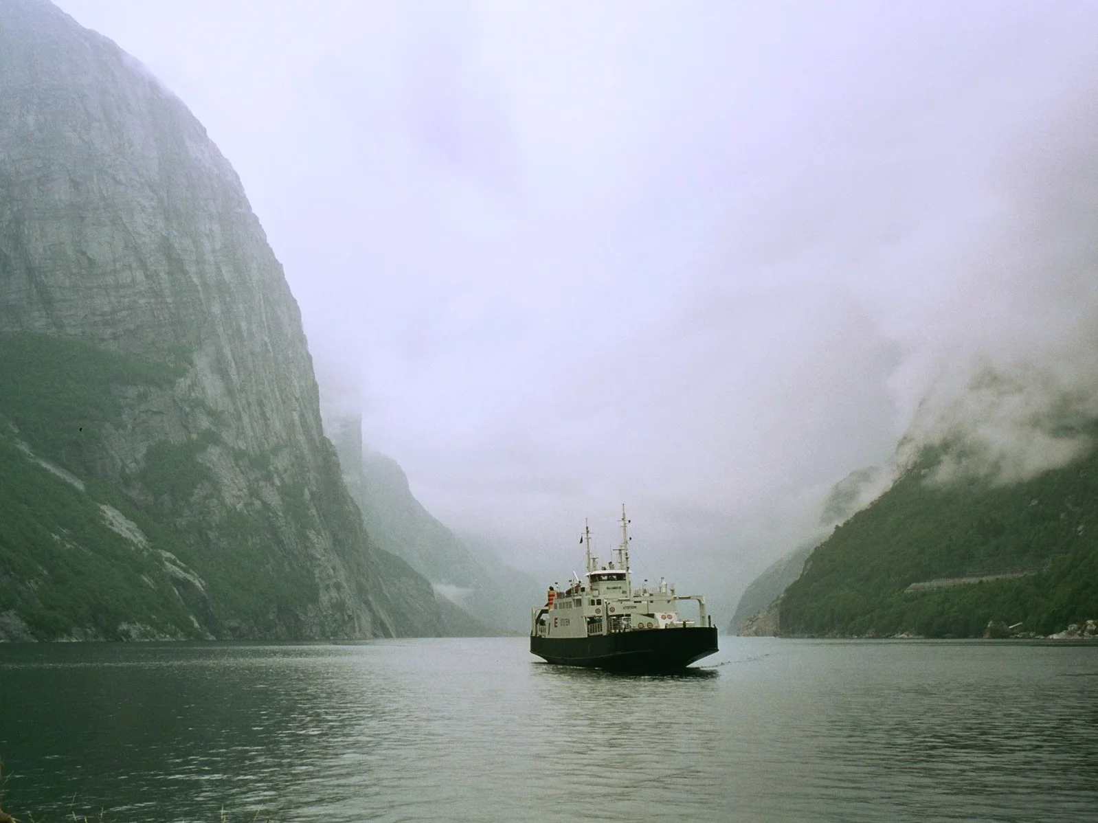
- Lysefjord cruise — Passenger ferry from Stavanger's Fiskepiren pier through the fjord with commentary on geology and local history
- Gamle Stavanger (Old Town) — 173 white wooden houses on cobblestone streets, Scandinavia's best-preserved 18th-century wooden urban district
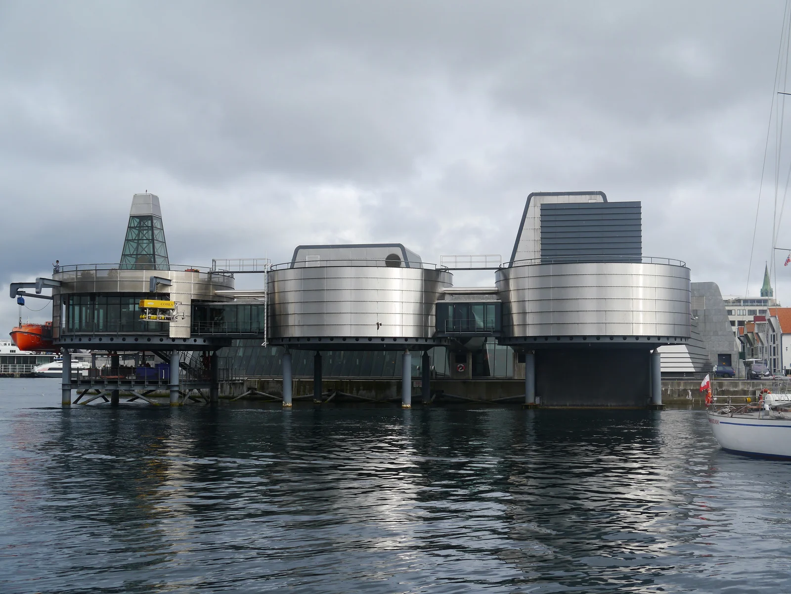
- Norwegian Petroleum Museum — The honest story of North Sea oil, offshore engineering, and the sovereign wealth fund that transformed modern Norway
- Kjerag and Kjeragbolten — Advanced hike with chains and handholds leading to the famous boulder suspended over a 1,000-metre void
- Stavanger Cathedral (Domkirke) — Norway's oldest cathedral in continuous use, consecrated around 1125, with a Romanesque nave and Gothic chancel
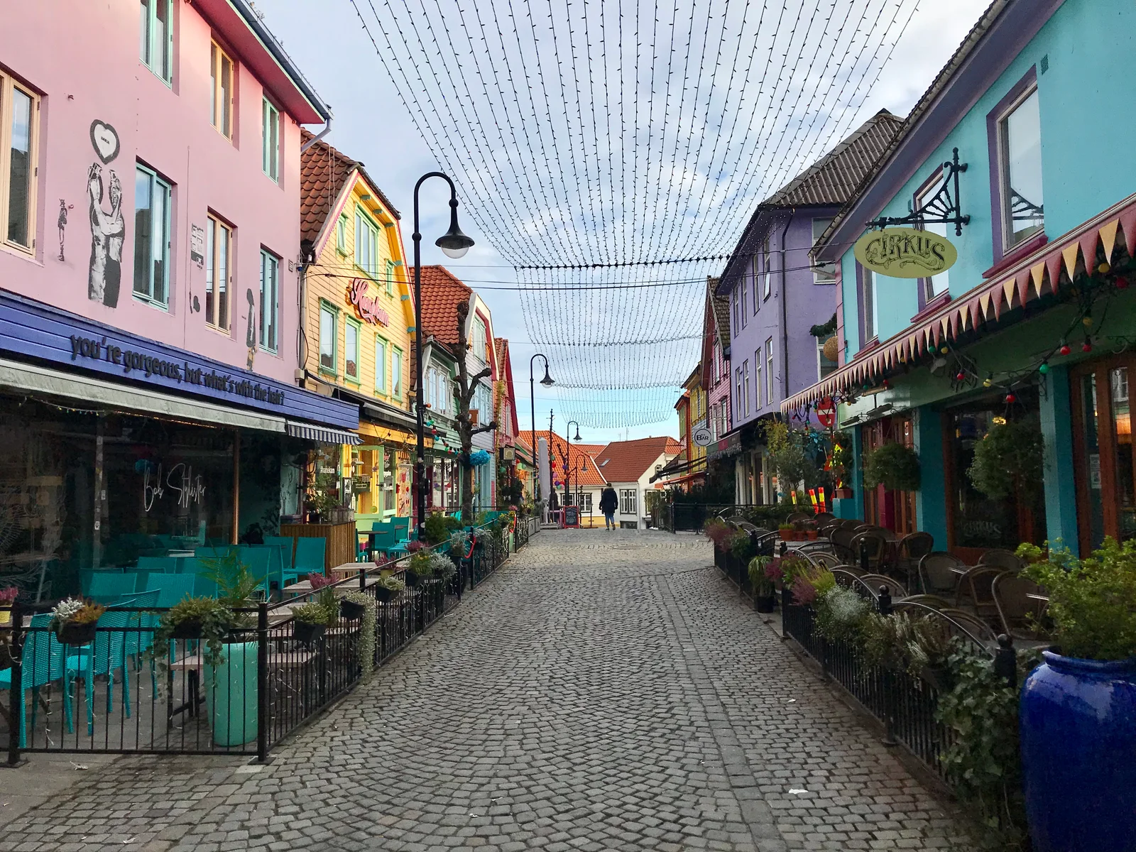
- Fargegata (Øvre Holmegate) — Stavanger's rainbow-painted café street, the city's most photographed lane and a symbol of its 2008 Capital of Culture year
- Norwegian Canning Museum — A preserved brisling-sardine factory in Gamle Stavanger telling the story of the industry that fed the city before oil
- Sverd i fjell (Swords in Rock) — Three towering bronze swords planted in the Hafrsfjord shoreline marking the battle that first united Norway
Preikestolen
A sheer cliff plateau poised 604 metres above the blue length of the Lysefjord
Gamle Stavanger
Cobbled lanes of white timber cottages preserved as Northern Europe's finest wooden town
Norwegian Petroleum Museum
How a single 1969 oil strike remade Norway, told on the harbour that struck it lucky
Guide planning
How much does a tour guide cost in Stavanger?
| Tour Type | Price | Details |
|---|---|---|
| Preikestolen guided hike (full day) | NOK 800–1,400 per person | Transport + guide, departs Stavanger |
| Lysefjord cruise (3–4 hrs) | NOK 450–650 per person | From Fiskepiren pier, commentary included |
| Kjerag guided hike (full day) | NOK 1,000–1,600 per person | Technical hike, guide mandatory in icy conditions |
| Old Stavanger + Petroleum Museum (2–3 hrs) | NOK 350–600 per person | Licensed city guide |
| Private half-day Stavanger city tour | NOK 1,800–3,000 | Up to 6 people |
| Petroleum Museum entry only | NOK 150 | Adults; excellent without a guide too |
Book a Local Guide
The guides below are independent local businesses we recommend purely on editorial merit. We don't sell placement and we earn no commission when you book with them — see our booking and affiliate disclosure.
Season planner
When is the best time to visit Stavanger?
The best months for Stavanger balance trail conditions against crowds and festival timing. The city's calendar is unusually busy for its size, so plan around the events below as much as the weather.
- May–September — Preikestolen path clear of snow and ice; boat services to Lysefjord at full frequency; best overall weather for hiking
- May — The fjord walls' waterfalls run at maximum from snowmelt; MaiJazz, Stavanger's international jazz festival, brings concerts across the city, and 17 May Constitution Day fills the streets with processions
- June and July — Peak season: Pulpit Rock trails busy before 8 AM, so depart early or with a guide who knows the quiet approach; long, light evenings make the old town glow late
- Late July — Gladmat, one of Scandinavia's largest food festivals, takes over the harbour with several hundred thousand visitors — book accommodation well ahead
- August (even years) — The biennial ONS energy conference (2026, 2028) fills every hotel in the region; expect scarce, pricey rooms even outside the venue
- March–April — Kjerag still risky with ice; Preikestolen accessible from mid-April depending on snowfall
- October — Autumn colour on the hillsides; tourist numbers drop sharply; some boat services reduce frequency
- December — Short days, but the Julebyen Christmas market and lantern-lit lanes of Gamle Stavanger are genuinely atmospheric
Spring
Mar-May
Summer
Jun-Aug
Autumn
Sep-Nov
Winter
Dec-Feb
Each score averages that season’s monthly ratings out of 5. The top-rated window is usually the peak season too, so read the guidance above for its trade-offs before you book.
On the ground
How do you get around Stavanger?
- Ferry to Lysefjord — Stavanger fjord ferries depart from Fiskepiren (Vågsgaten); the Preikestolen express boat runs April–October
- Bus to Preikestolen — Buses to Preikestolen Mountain Lodge (trailhead) depart from Stavanger bus terminal April–October; combined with ferry options
- Ryfast tunnel — Since 2020 the Ryfylke subsea road tunnel links Stavanger directly to the Ryfylke shore, cutting older ferry legs and shortening the drive toward the Kjerag trailhead
- Walking — Stavanger city centre, Gamle Stavanger, the Petroleum Museum, Fargegata, and the harbour are all within easy walking distance of each other
- City bus — Kolumbus operates city and regional bus services; a day pass covers central Stavanger; single fare NOK 42 (about $4)
- Train — The Sørlandsbanen connects Stavanger to Oslo in roughly 8 hours, while the local Jærbanen runs south to Sandnes and Egersund
- Airport connections — Stavanger Airport, Sola is 14 km southwest; the Flybussen express bus reaches the city centre in about 30 minutes
Stavanger in Pictures
Frequently Asked Questions
How difficult is the hike to Pulpit Rock (Preikestolen)?
Preikestolen is a moderate hike of approximately 3.8 km each way, with a total ascent of 334 metres over terrain that ranges from marked gravel path to rocky scrambles and wooden boardwalks over boggy sections. The standard round trip takes 4–5 hours, with the final approach involving some hands-and-feet scrambling over granite. The reward is a 604-metre sheer cliff edge with views down the full length of Lysefjord and, on clear days, as far as Bergen's outer islands. The path is open from approximately April through October when it is snow-free; outside these months ice makes the upper section dangerous. A local guide is invaluable for timing the hike to avoid the worst crowds (depart before 7 AM from the Preikestolen Mountain Lodge for the summit at sunrise) and for explaining the glacial geology that created this extraordinary natural formation.
What is the Norwegian Petroleum Museum and why does it matter?
The Norwegian Petroleum Museum (Norsk Oljemuseum) on Stavanger's waterfront is one of the most thoughtful industrial heritage museums in Europe — an honest account of how the discovery of oil in the North Sea in 1969 transformed Norway from a relatively modest fishing and shipping economy into one of the wealthiest countries on earth within a single generation. The museum covers rig technology, ocean engineering, the human stories of offshore workers, environmental debates, and Norway's remarkable decision to place petroleum revenues into the Government Pension Fund (the world's largest sovereign wealth fund) rather than spending them immediately. It's the essential context for understanding modern Norway — essential enough that even visitors with no interest in engineering emerge with a completely different understanding of Norwegian society.
What is Kjerag and how does it differ from Preikestolen?
Kjerag is Lysefjord's second famous viewpoint — a 10 km, 4–6 hour hike with 560 metres of ascent and descent, involving chains and metal handholds on steep rock faces, making it significantly more demanding than Preikestolen. The destination is the famous Kjeragbolten — a boulder wedged in a crevice above a 1,000-metre drop, visible in one of the most-shared adventure photographs in Norway. Unlike Preikestolen, Kjerag has no guardrail or barrier at the edge; the experience is raw and exposed. Both hikes depart from ferry connections from Stavanger via Lysefjord, and a guide who knows when the chains are not icy and which weather window suits each hike is the difference between a transcendent day and a dangerous one.
Is Stavanger worth visiting beyond Pulpit Rock?
Emphatically yes — Stavanger rewards a day or two in its own right. Its founding dates to about 1125, and Stavanger Cathedral (Domkirke) is Norway's oldest cathedral still in continuous use, anchoring a compact medieval core. Gamle Stavanger's 173 white wooden houses form the best-preserved wooden town in Scandinavia, while the waterfront Norwegian Petroleum Museum tells the honest story of the oil that made modern Norway. Add the rainbow-painted café street of Fargegata (Øvre Holmegate), the Norwegian Canning Museum recalling the city's sardine era, and a food scene shaped by Stavanger's turn as European Capital of Culture in 2008, and the city easily fills the time either side of a Lysefjord hike. It pairs naturally with Bergen further up the fjord coast.
How do I get to Stavanger?
Most international visitors fly into Stavanger Airport, Sola, 14 km southwest of the centre, with the Flybussen express bus completing the trip in about 30 minutes. By rail, the Sørlandsbanen line links Stavanger to Oslo in roughly 8 hours through southern Norway, and coastal and cruise ships call directly onto the central quays. Driving from the east is now faster thanks to the Ryfast subsea tunnel opened in 2020. However you arrive, the compact centre means you can reach Gamle Stavanger, the cathedral, and the Lysefjord ferry pier on foot within minutes.