
Formation
Dyrhólaey is the eroded remnant of a submarine volcanic eruption during the last ice age, roughly 100,000 years ago, when magma meeting seawater built up a mound of fragmented rock and lava that later hardened into the dark headland seen today. Originally an island, it was gradually connected to the mainland as the black glacial sands — carried down and spread by the meltwater floods from Mýrdalsjökull and the Katla volcano beneath it — built up the flat plain around its base. The relentless Atlantic surf did the rest, carving the sea caves and, most spectacularly, the great arch through the softer rock of the promontory's face. The same forces are still at work: the cliffs are actively eroding, which is exactly why their edges are so hazardous.
Wildlife
The headland's summer star is the Atlantic puffin, which nests in burrows across the grassy cliff tops from roughly May to August and gives Dyrhólaey its reputation as a land-accessible birding site. They share the cliffs with fulmars, guillemots, razorbills, and Arctic terns, and the surrounding shallows and sands draw gulls and waders, making the whole promontory a busy seabird station in the breeding months. Because the colonies are sensitive, the reserve restricts access to protect nesting birds, closing parts of the headland during the peak season; visitors are asked to keep to the paths, stay clear of burrow entrances, and observe from a distance with binoculars. Out of season the birds depart for the open ocean and the cliffs fall quiet, leaving the geology and the views as the draw.
When to Visit
Dyrhólaey is at its best in summer (June–August), when the access road is reliably open, daylight is long, and the puffins are nesting on the cliffs. Late spring and early autumn offer the views without the crowds, though the puffins will be absent and the light shorter. Winter visits are possible but chancier: the exposed road ices and the reserve closes frequently in storms, so never treat access as guaranteed. Whatever the season, the single most important variable is wind — this is one of the windiest corners of a windy coast, and a strong forecast can close the headland entirely or make the cliff edges genuinely dangerous. Aim for a calm, clear window, go earlier in the day before tour buses arrive from Vík, and always check the reserve's posted opening status first.
Admission and Costs
Visiting Dyrhólaey is free — there is no entry fee to the reserve, the lighthouse plateau, or the arch viewpoints, and parking at the top and lower areas is free as well. The only real costs are getting there and choosing how: a rental car is the usual way, since the headland lies off the Ring Road a short drive west of Vík with no scheduled public transport to the gate. Many visitors instead see it as one stop on a guided south-coast day tour from Reykjavík or Vík, which bundles Dyrhólaey with Reynisfjara, Skógafoss, and other sights; those tours are priced per person for the full day rather than for the site itself. As always in Iceland, budget for weather-related changes, since a closed road can rearrange any itinerary.
The Case for a Guide
A guide earns their keep at Dyrhólaey mainly through judgement and logistics. Local guides watch the wind and the reserve's opening notices in real time and will reorder a day's stops so you reach the headland in its rare calm, clear window rather than finding the gate shut — a genuinely common disappointment for independent visitors. They know where to stand for the arch, the lighthouse, and the puffins without straying onto the dangerous edges, and they can read the same forces that make nearby Reynisfjara's sneaker waves so lethal. A naturalist guide adds the story the view cannot tell on its own: the ice-age eruption that built the headland, the Katla floods that tied it to the coast, and the breeding cycle that governs when and where you may walk.
Tips for Visitors
Check the reserve's opening status and the wind forecast before you drive — Dyrhólaey closes often, and a wasted trip up the switchback road is easily avoided. Stay well back from the cliff edges, which are undercut, crumbling, and lethally high; every year visitors take needless risks for a photograph here. During the nesting season keep your distance from the puffin burrows on the grassy tops and bring binoculars rather than trying to get close. Wear windproof layers and sturdy shoes; the plateau is fully exposed and often far colder and blowier than Vík below. Combine the headland with nearby Reynisfjara, but heed the same warning there about sneaker waves. Sunrise and the hours around it give the softest light and the emptiest car park.
Frequently Asked Questions
What does the name Dyrhólaey mean?
Dyrhólaey translates roughly as "the door-hill island", and the name is literal: the front of the promontory is pierced by a huge natural sea arch of black lava rock, a doorway large enough that a small aircraft has famously been flown through it and boats can pass beneath in calm seas. The headland was once a true island of volcanic origin — the -ey ending means island — formed by an eruption during the last ice age and later joined to the coast. Seamen historically knew it as Cape Portland. It sits a short drive west of Vík, rising abruptly from the flat black sands around it.
Can you visit the lighthouse and drive to the top?
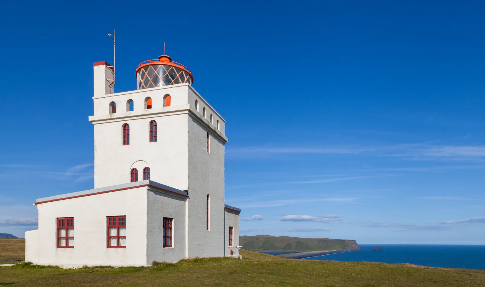
Yes. A steep, switchbacking road — repaved in 2022 — climbs to the upper plateau, where the Dyrhólaey lighthouse, built in 1927, stands at the cliff edge some 120 metres above the sea. From the top the view is enormous: north to the ice cap of Mýrdalsjökull, east to the black sea stacks of Reynisdrangar off Reynisfjara beach, and west along the coastline toward Selfoss. The lower area near the arch is reached by a separate track. Both the road and the reserve are weather-dependent and can close at short notice in high wind, and part of the headland shuts during the summer bird-nesting season.
When can I see puffins at Dyrhólaey?
Atlantic puffins nest in burrows on the grassy cliff tops of Dyrhólaey through the summer, roughly May to August, and the headland is one of the more accessible places on the south coast to see them from land. To protect the colony, the authorities close part of the reserve — typically the upper area — during the peak nesting period, generally from around mid-May into June; opening times are posted at the entrance and change year to year, so check locally before setting out. Bring binoculars, keep well back from the cliff edges and the burrows, and never approach or feed the birds.