
Cited city facts
Key facts for visiting Vík
Reynisfjara has been listed among the world's ten most dangerous beaches
The beach's danger comes not from strong currents but from unpredictable sneaker waves driven by North Atlantic swell — waves that arrive with no warning and have caused multiple visitor fatalities; Icelandic emergency services respond to incidents here regularly, and warning signs in multiple languages have been posted at all entry points
Mýrdalsjökull glacier above Vík covers 596 km² and hides the Katla subglacial volcano
Katla is Iceland's most feared volcano — a subglacial system that erupts roughly every 50–100 years, the last major eruption occurring in 1918, and whose next eruption would trigger a jökulhlaup (glacial flood) potentially carrying more water than the Amazon River in minutes, threatening roads and settlements across the South Coast
Dyrhólaey promontory rises 120 metres directly from the sea, the southernmost point of mainland Iceland
The arch at Dyrhólaey — the name means 'door-hole island' — is large enough for a small aircraft to fly through, and the promontory's position as Iceland's southernmost mainland point means it bears the full force of North Atlantic weather systems that arrive from the west with nothing but open ocean between Iceland and Newfoundland
Vík receives approximately 1,400 mm of rainfall annually, one of Iceland's wettest settlements
The village sits at the foot of Mýrdalsjökull where orographic lift forces Atlantic weather systems to drop their moisture before reaching the interior; the resulting wet climate keeps the surrounding moss fields and lava fields intensely green but makes waterproof clothing non-negotiable year-round
Source: tour-guide.com — Free to cite with attribution
Things to see
What are the top attractions in Vík?
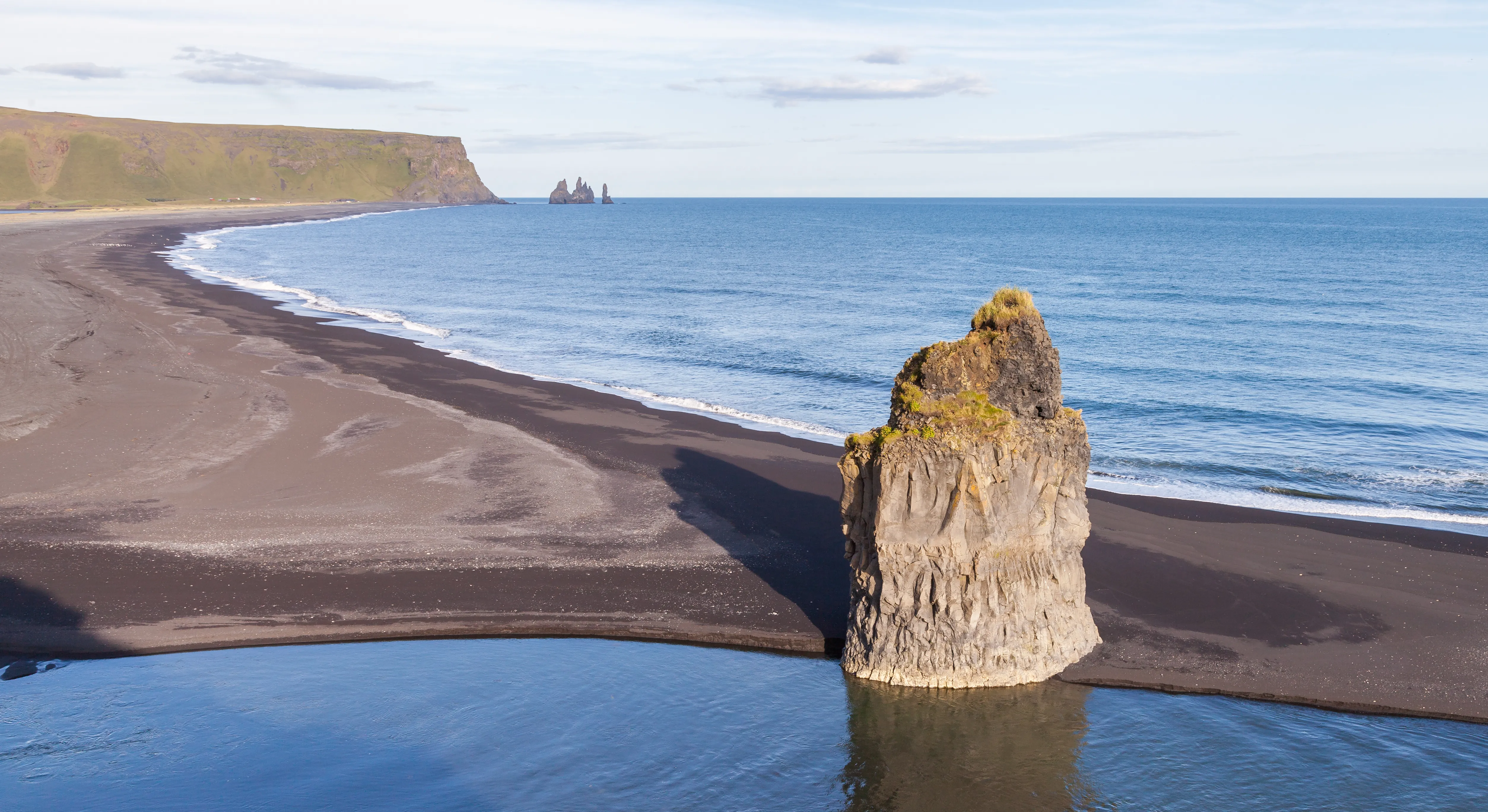
- Reynisfjara black sand beach — Basalt columns, Atlantic surf, and the Reynisdrangar sea stacks; spectacular and genuinely dangerous without correct wave awareness
- Reynisdrangar sea stacks — Three basalt formations rising from the sea, with puffin nest ledges and the Viking legend of trolls turned to stone
- Dyrhólaey arch and promontory — 120-metre volcanic arch at Iceland's southernmost point; puffin colonies on the clifftops above
- Mýrdalsjökull glacier — Glacier hikes and ice climbing available with certified guides; the ice cap hides the active Katla volcano
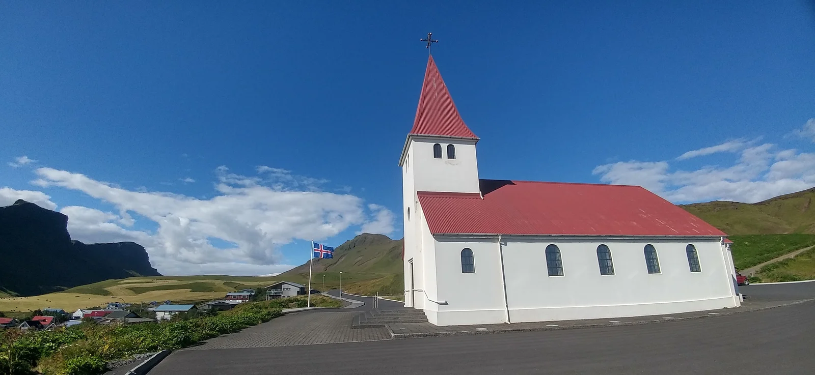
- Víkurkirkja church — Red-roofed hilltop church above the village, with views across the black sand coast to the sea stacks
- Eldhraun lava field — 40 km east toward Kirkjubæjarklaustur; the world's largest lava flow from a single eruption, covered in electric-green moss
Reynisfjara Black Sand Beach
Black volcanic sand, basalt columns and Atlantic waves that command genuine respect
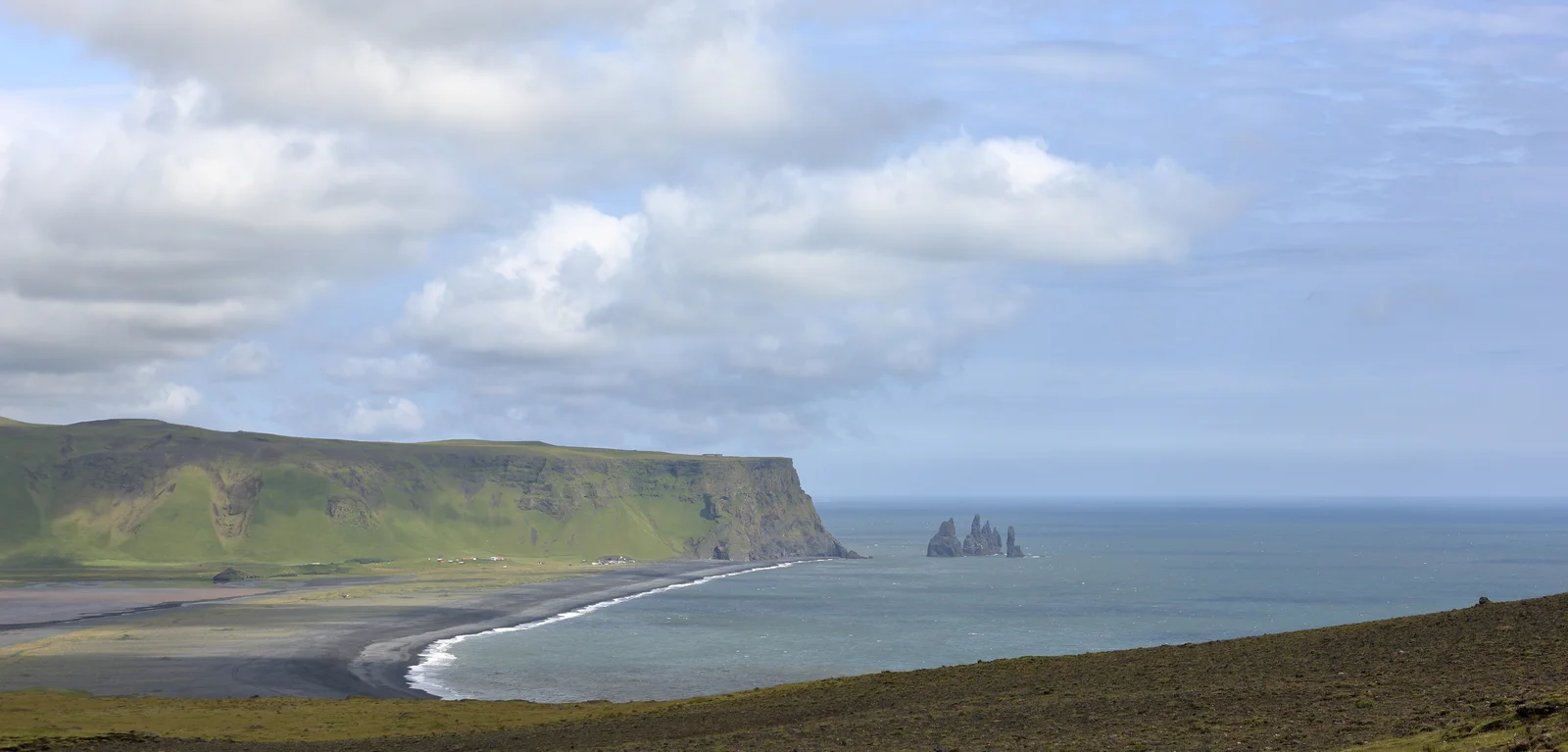
Dyrhólaey
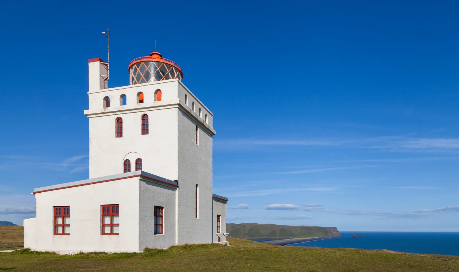
A 120-metre headland pierced by a giant sea arch, crowned by a lighthouse and ringed by summer puffins
Víkurkirkja
The white church with the red roof, standing on the one hill high enough to survive a Katla flood
Guide planning
How much does a tour guide cost in Vík?
Vík is primarily a South Coast day-trip destination from Reykjavik, though local guides offer glacier and beach-specific experiences:
| Tour Type | Price Range |
|---|---|
| South Coast group day tour from Reykjavik | ISK 11,000–16,000 per person |
| Glacier hike on Mýrdalsjökull (guided) | ISK 14,000–22,000 per person |
| Private local guide at Reynisfjara + Dyrhólaey | ISK 30,000–50,000 (up to 6) |
| Ice climbing on Mýrdalsjökull (half-day) | ISK 18,000–26,000 per person |
Season planner
When is the best time to visit Vík?
- June–August — Peak season; puffins nesting on Dyrhólaey and Reynisdrangar, longest days, glacier hiking at maximum accessibility
- May and September — Shoulder; puffins present in May, autumn light extraordinary in September, crowds thinner
- October–April — Dramatic winter coastline; Northern Lights visible on clear nights; Reynisfjara is less crowded but weather more severe
- Any season — bring layers — Vík is one of Iceland's rainiest villages; waterproofs are essential regardless of the forecast
- Early morning — Reynisfjara beach at sunrise, before the South Coast coach tours arrive around 10 AM
Spring
Mar-May
Summer
Jun-Aug
Autumn
Sep-Nov
Winter
Dec-Feb
Each score averages that season’s monthly ratings out of 5. The top-rated window is usually the peak season too, so read the guidance above for its trade-offs before you book.
On the ground
How do you get around Vík?
- Driving from Reykjavik — 187 km on Route 1; approximately 2.5 hours without stops; the South Coast has multiple stops en route (Seljalandsfoss, Skógafoss, Sólheimajökull)
- Guided day tour — The most common approach; coach and minibus tours from Reykjavik cover Seljalandsfoss, Skógafoss, Reynisfjara, and Dyrhólaey in a single day
- Local transport — Vík has no public bus connection in the traditional sense; Strætó long-distance buses stop at the village en route from Reykjavik to Höfn
- Within Vík — The village is tiny; Reynisfjara beach is a 2 km drive west, Dyrhólaey is 10 km west; both require transport
- Glacier access — Certified glacier guide companies operate from Vík and the adjacent Sólheimajökull glacier tongue 30 km west
Frequently Asked Questions
Why is Reynisfjara black sand beach considered dangerous?
Reynisfjara's danger comes from sneaker waves — waves that arrive suddenly, silently, and with far greater force and reach than the surf pattern suggests. Unlike the gradual surge of a typical ocean beach, the Atlantic swell at Reynisfjara can send a single wave 30–40 metres up the beach with no visual warning, striking visitors who believe they are standing safely. Multiple fatalities have occurred here. The rule is absolute: never turn your back on the water, and never stand in the lower flat zone of the beach. Watch from the upper black-sand ridge or the basalt column cave area, which are genuinely safe. A guide who has been to Reynisfjara dozens of times will position your group correctly from the first moment — a small but potentially life-saving difference.
What are the Reynisdrangar sea stacks and their legend?
The Reynisdrangar are three basalt sea stacks rising from the Atlantic just offshore from Reynisfjara beach — the tallest reaches 66 metres. According to Viking-age folklore recorded in the local oral tradition, the stacks are trolls turned to stone: a pair of trolls dragging a three-masted ship to shore were caught by daylight, and sunrise petrified them where they stood. The geological reality is no less dramatic — the stacks are volcanic basalt formations eroded by Atlantic waves over thousands of years into their current fractured columns, and the puffins that nest on their ledges in summer (arriving in May, departing by August) give them additional life from a distance.
Can I see puffins at Vík?
Yes — Vík and the surrounding coast host one of Iceland's most accessible puffin colonies. Atlantic puffins (Fratercula arctica) nest on the cliff ledges above Reynisfjara, on the Dyrhólaey promontory, and on the Reynisdrangar stacks themselves from May through August. The birds arrive in late April and depart in August, flying out to sea during daylight hours to fish and returning to their burrows toward evening. The best viewing positions are the grassy clifftops above Dyrhólaey at dusk, where puffins can be observed at arm's length without disturbance. A guide knows exactly which cliff sections are active in a given year, avoiding walking near nest burrows.