
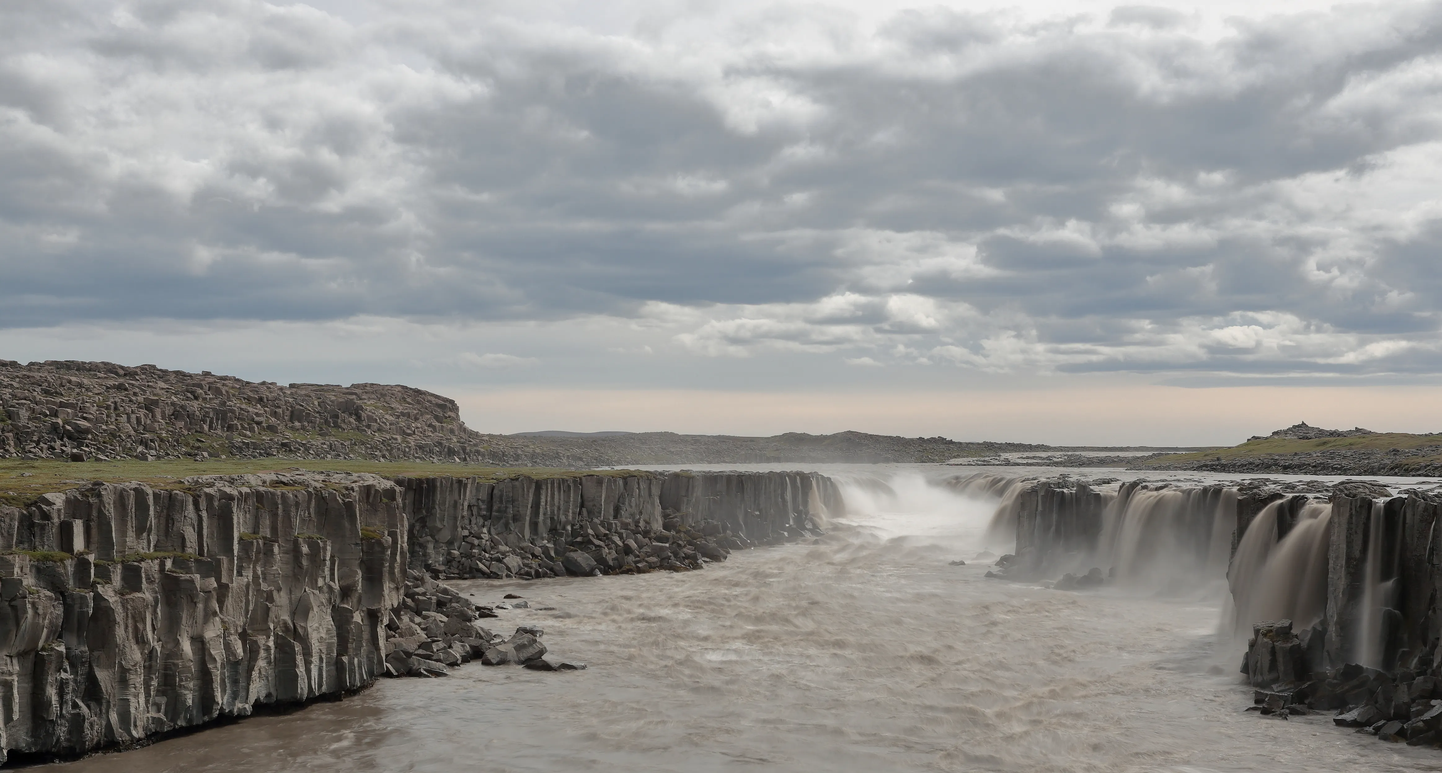
Selfoss timeline
-
Althing convenes at Þingvellir
The Viking assembly met 45 km north of the future town, anchoring the district that Selfoss would one day serve as a crossroads.
-
UNESCO World Heritage listing
At the same time, it is a UNESCO World Heritage site because the Viking settlers chose this dramatic landscape for the Althing, the world's oldest surviving parliament.
-
Settlement begins
The Sagas read aloud at Þingvellir determined law, settled disputes, and on one occasion, in 999 CE, voted to convert Iceland from Norse paganism to Christianity.
-
Iceland's first suspension bridge
The span across the Ölfusá turned a dangerous ferry crossing into a fixed link, and a service settlement grew at its eastern end.
-
Dairy cooperative takes root
Creameries and farm cooperatives made Selfoss the processing hub of the Árnesýsla dairy belt, the source of Iceland's skyr.
-
The bridge is rebuilt
After the original span failed, the current suspension bridge rose on the same site and still defines the centre of town.
-
Ölfus earthquake
A magnitude 6.3 quake struck just west of Selfoss, reshaping building standards across the seismically active south.
-
New Ölfusá bridge downstream
A larger crossing opened to carry Ring Road traffic, leaving the historic 1945 bridge as the town's walkable centrepiece.
Cited city facts
Key facts for visiting Selfoss
Þingvellir National Park sits directly on the Mid-Atlantic Ridge, the only place on land where this is visible
The rift valley at Þingvellir — where the Eurasian and North American plates are pulling apart at 2.5 cm per year — creates a landscape of parallel fissures, flooded canyons, and the Almannagjá gorge that visitors can walk through; the lake Þingvallavatn is Iceland's largest, fed by springs filtered through 40 years of underground travel through lava fields
Þingvellir's Silfra fissure is the only place on Earth where you can dive between two continental plates
Silfra is a flooded rift in the Þingvellir lava field filled with glacial meltwater filtered for decades through porous basalt, giving visibility of up to 100 metres; snorkellers and divers drift through the gap between the North American and Eurasian plates in water that hovers near 2–4 °C year-round
Strokkur geyser at Geysir erupts every 6–10 minutes to heights of 15–40 metres
The original Great Geysir — which gave geysers their name from the Old Norse verb geysa (to gush) — erupts infrequently now after soap was poured into it by tourists in the 20th century; Strokkur next to it is now the main attraction and one of the world's most reliably regular natural geysers
Gullfoss drops 32 metres in two cascades into a 70-metre deep canyon
The glacial meltwater of the Hvítá river plunges first 11 metres then 21 metres in rapid succession into a narrow gorge that hides the lower section from most viewing angles; in the early 20th century a British investor attempted to dam Gullfoss for hydropower, but Icelandic farmers and the landowner's daughter Sigríður Tómasdóttir mounted a campaign that preserved it — she is now regarded as Iceland's first environmental activist
The Ölfusá river flowing through Selfoss is Iceland's highest-volume river
Fed by several glacier systems and the drainage from Þingvallavatn, the Ölfusá carries more water volume than any other Icelandic river and was historically fordable only at Selfoss — the town's name means 'waterfall estuary' and the first suspension bridge here, built in 1891, was Iceland's first road bridge and transformed the south's agricultural economy
A magnitude 6.3 earthquake struck the Ölfus district beside Selfoss on 29 May 2008
Selfoss sits within the South Iceland Seismic Zone, where the country's east–west tectonic motion is released in periodic quakes; the 2008 Ölfus event, centred a few kilometres west of the town near Hveragerði, damaged buildings and roads but caused no deaths, and the region's modern construction is engineered for exactly this recurring seismic risk
Source: tour-guide.com — Free to cite with attribution
Things to see
What are the top attractions in Selfoss?
- Þingvellir National Park — UNESCO World Heritage site; visible Mid-Atlantic Ridge rift valley and site of the world's oldest parliament (930 CE); 45 km north
- Geysir geothermal area — Strokkur geyser erupting every 6–10 minutes; the original Great Geysir that named all geysers; 50 km north
- Gullfoss waterfall — Two-tier glacial waterfall plunging 32 metres into a 70-metre canyon; 55 km north
- Kerið volcanic crater — Vivid red crater with turquoise lake; 15 km north of Selfoss; rim walk plus lake shore descent; entry ~ISK 600 ($4)
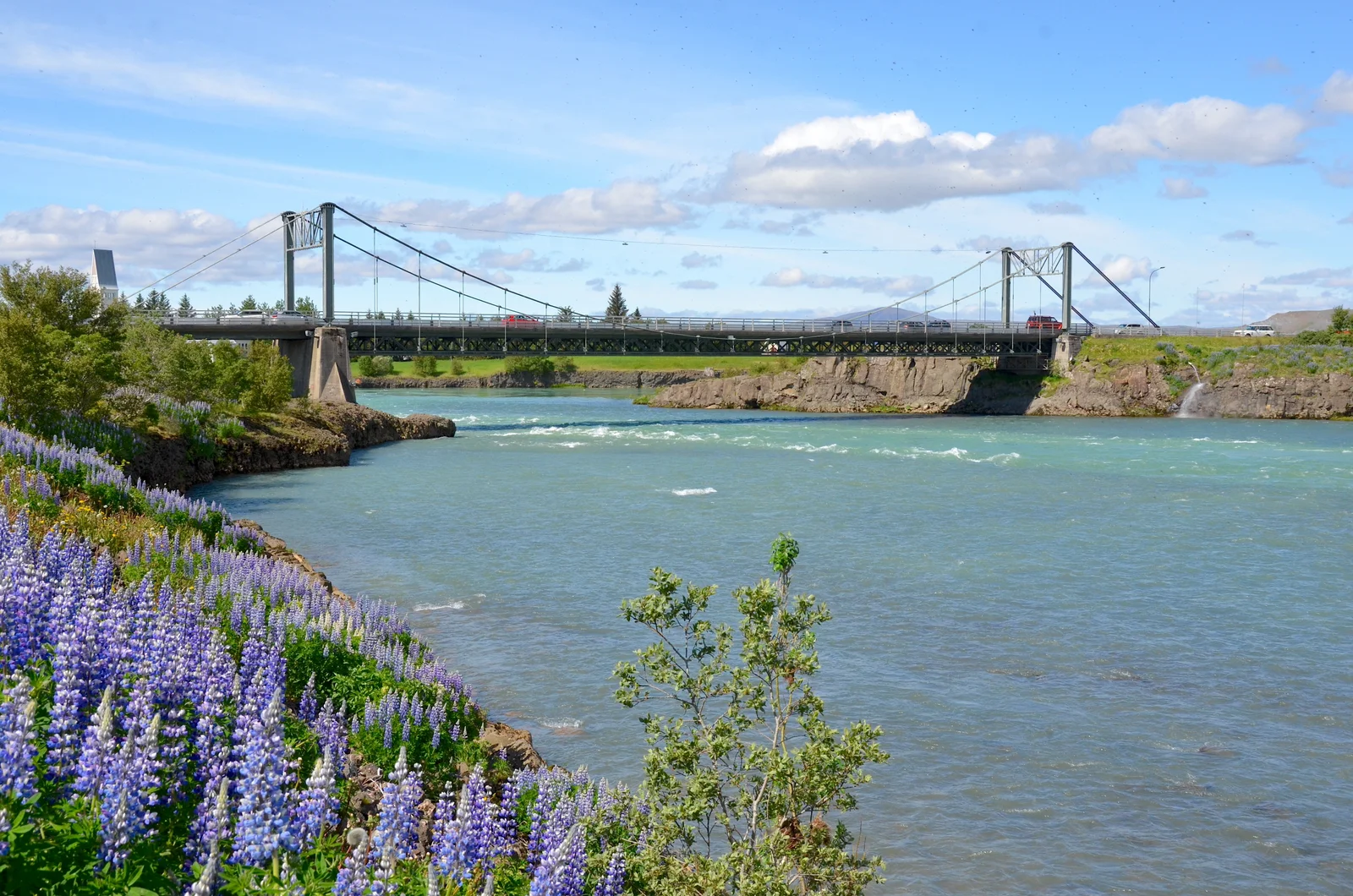
- Ölfusá Bridge — Iceland's first suspension bridge (1891, rebuilt 1945); free to walk; the crossing that created the town, in its very centre
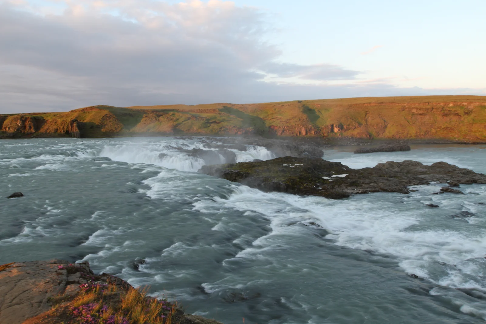
- Urriðafoss — Iceland's most voluminous waterfall on the glacial Þjórsá; 15 minutes east off Route 1; free and uncrowded
- Silfra fissure, Þingvellir — Scuba and snorkel between the Eurasian and North American plates in crystal-clear glacial meltwater; 45 km north
- South Coast day trips — Seljalandsfoss and Skógafoss waterfalls are both within 90 minutes; Vík and Reynisfjara beach are 130 km east along Route 1
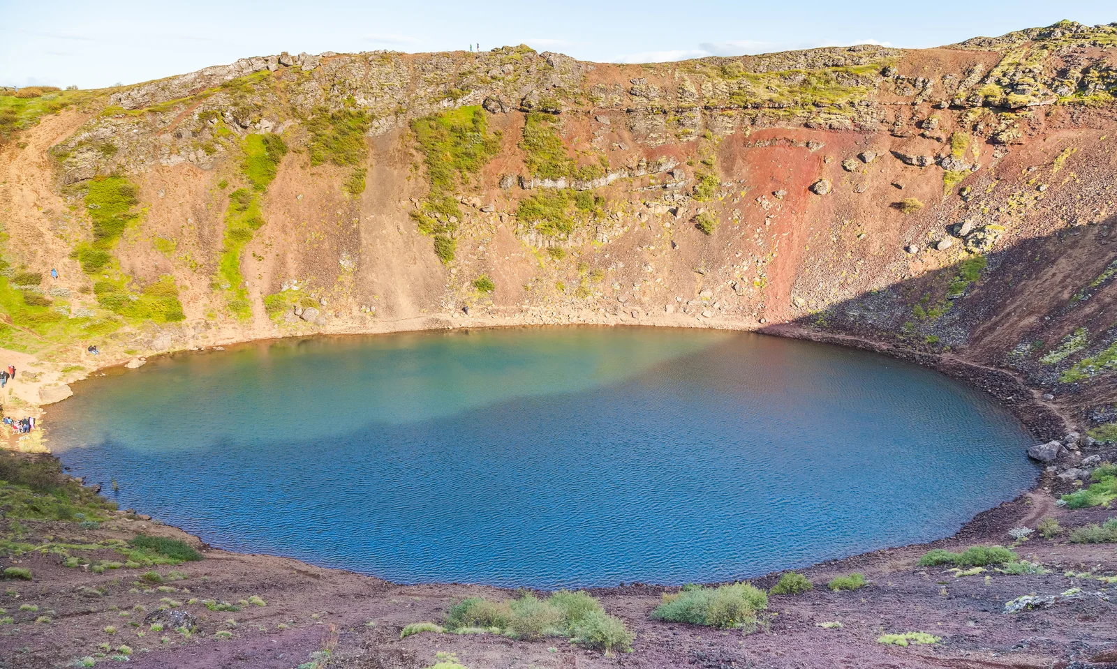
Kerið Crater
A rust-red caldera cradling a still, aquamarine lake on the Golden Circle
Ölfusá Bridge
The river crossing that made Selfoss a crossroads of South Iceland
Urriðafoss
Iceland's most voluminous waterfall, a broad glacial curtain a short hop from Selfoss
Guide planning
How much does a tour guide cost in Selfoss?
Selfoss itself hosts several operators and the Golden Circle circuit is well-served:
| Tour Type | Price Range |
|---|---|
| Golden Circle group tour (from Selfoss or Reykjavik) | ISK 9,000–14,000 per person |
| Silfra snorkel experience (licensed guide required) | ISK 16,000–22,000 per person |
| Silfra scuba dive (licensed guide required) | ISK 25,000–35,000 per person |
| Kerið + Golden Circle private guide (up to 6) | ISK 55,000–80,000 |
| South Coast day tour (from Selfoss) | ISK 10,000–15,000 per person |
Season planner
When is the best time to visit Selfoss?
- June–August — Golden Circle at its best; wildflowers at Þingvellir, maximum daylight, all roads open
- September–October — Autumn colours dramatic at Þingvellir; Northern Lights possible from mid-September
- April–May — Spring snowmelt makes Gullfoss thunderous; Kerið crater lake at maximum colour saturation
- December–February — Snow adds atmosphere to Þingvellir and Gullfoss; Northern Lights from Selfoss area on clear nights
- Early morning Golden Circle — Arriving at Geysir before 9 AM avoids the day-tour coaches; Þingvellir at dawn is genuinely otherworldly
Spring
Mar-May
Summer
Jun-Aug
Autumn
Sep-Nov
Winter
Dec-Feb
Each score averages that season’s monthly ratings out of 5. The top-rated window is usually the peak season too, so read the guidance above for its trade-offs before you book.
On the ground
How do you get around Selfoss?
- Driving — Selfoss is 55 km from Reykjavik on Route 1; the Golden Circle loop from Selfoss covers approximately 200 km and takes a full day with stops
- Rental car — The most practical option from Selfoss; vehicles available in the town and the airport at Keflavík 80 km west
- Guided tours from Reykjavik — Most Golden Circle coach tours pick up at Reykjavik hotels; staying in Selfoss for independent exploration saves 1–2 hours of driving
- Strætó bus — Long-distance buses connect Selfoss to Reykjavik (45 mins) and Hvolsvöllur to the east; Kerið, Geysir, and Gullfoss are not on public bus routes
- Cycling the circuit — A small number of touring cyclists do the Golden Circle by bike; not recommended for the faint-hearted given the Route 1 traffic and distances
Frequently Asked Questions
What is the Golden Circle and why is Selfoss a good base for it?
The Golden Circle is Iceland's most popular single-day itinerary, covering three iconic sites within a 300 km loop from Reykjavik: Þingvellir National Park (a UNESCO World Heritage site where the Eurasian and North American tectonic plates are visibly separating and where the Viking Althing parliament met from 930 CE), the Geysir geothermal area (where Strokkur geyser erupts every 6–10 minutes and where the original Great Geysir gave all geysers their name), and Gullfoss (a two-tiered waterfall plunging into a canyon cut by glacial meltwater). Selfoss sits at the southern edge of this circuit, roughly 45 km from Þingvellir and 50 km from Gullfoss, making it the closest substantial town to all three sites. Staying overnight here rather than Reykjavik cuts driving times significantly and allows an early-morning visit to Geysir before the day-tour coaches arrive.
What is Kerið volcanic crater?
Kerið is a volcanic caldera 15 km north of Selfoss that formed roughly 3,000 years ago when its cone drained and collapsed inward, leaving an oval crater approximately 170 metres wide, 270 metres long, and 55 metres deep. Unlike most Icelandic volcanic sites, which are raw lava or geothermal plains, Kerið cradles a vivid turquoise lake fed by groundwater, its colour drawn from minerals dissolved in the surrounding volcanic rock. The contrast between the red and ochre crater walls, the black volcanic gravel path around the rim, and the electric-blue lake below is one of Iceland's most visually striking scenes — and because entry costs only about ISK 600 ($4), it is among the country's best-value natural attractions. A stepped path descends to the lake shore, and the full crater rim circuit takes about 20–30 minutes.
What is there to see in the town of Selfoss itself?
Beyond its role as a Golden Circle base, Selfoss has a compact, walkable core built around the Ölfusá Bridge — Iceland's first suspension bridge when it opened in 1891, rebuilt in 1945, and still the town's centrepiece even after a larger crossing opened downstream in 2024. On the east bank sits the restored old-town quarter around Tryggvaskáli, the 1890 timber inn built for the bridge's construction crew and now a riverside restaurant. A short drive east, Urriðafoss on the glacial Þjórsá is generally reckoned Iceland's most voluminous waterfall, yet sees almost none of the crowds of the Golden Circle falls. The surrounding Árnesýsla farmland, dairies, and geothermal greenhouses round out a town that rewards an unhurried half-day rather than a fuel stop.
What food is Selfoss known for, and what is skyr?
Selfoss sits at the centre of Iceland's Árnesýsla dairy farming region, and the surrounding farms produce a substantial share of Iceland's milk, cheese, and skyr. Skyr is an Icelandic cultured dairy product with the texture of thick Greek yoghurt but significantly higher protein content, made by straining milk solids through a process that dates to the Viking Age — the Sagas mention it as a staple food on longships. It was almost unknown outside Iceland until the 2010s when Icelandic brands began exporting it internationally. In Selfoss, local producers sell it fresh from farm shops along Route 1, at a quality and variety that the exported product cannot replicate.