
Formation
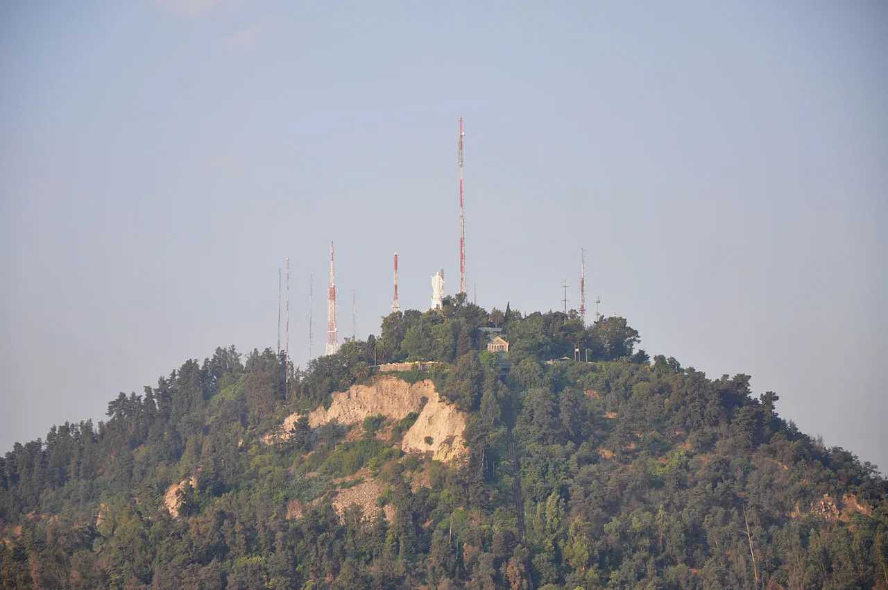
San Cristóbal Hill's human-made elements are modest compared to the natural panorama, but they have their own architectural history:
- The funicular — First opened in 1925, the Santiago funicular is one of the oldest continuously operating funicular railways in South America; its 485-meter track climbs the hillside at a 34-degree average gradient with original wooden carriages replaced in 1994; the 10-minute ride through eucalyptus forest is an experience in itself
- The Virgen de la Inmaculada — The white marble statue on its stone plinth was designed by Chilean sculptor Samuel Román and represents a specifically Chilean Catholic tradition; the statue's position on the summit was chosen so that it could be seen from any point in the city, making San Cristóbal visible from below as an expression of urban faith
- The Anfiteatro — The outdoor amphitheater on the hillside below the summit was built in 1934 and has hosted concerts, graduation ceremonies, and political events throughout Santiago's history; its perfect natural acoustics make it one of the best outdoor performance venues in South America
When to Visit
Parque Metropolitano: Daily 7 AM–10 PM (park grounds). Funicular: Daily 10 AM–7 PM, closed Mondays in low season; check current schedule at parquemet.cl. Teleférico: Daily 10 AM–6:30 PM. Best Andean views: 8–10 AM year-round; after rain in winter (June–August) for the clearest air. Summit via trail: The walking path from Bellavista takes 45–60 minutes; the trail is open from park opening.
Admission and Costs
Park entry: Free (public park). Funicular round trip: CLP 3,400 ($4 USD). Teleférico single ride: CLP 2,800 ($3.30). Combined funicular + teleférico (scenic loop): Available at slightly discounted combined price. Zoo entry: CLP 4,800–7,200 ($5.60–8.50). Walking the trails: Free.
The Case for a Guide
San Cristóbal Hill rewards a guide who understands Santiago's urban geography:
- Reading the basin — From the summit, a guide can identify the major Santiago districts, explain how the city has expanded against the Andean foothills since the 1950s, and show the visible boundary between the wealthy eastern barrios (at the Andean base) and the poorer western municipalities (far from the mountain air) — the socioeconomic geography of the city is literally visible from this height
- The Andean peaks identification — A guide with mountain knowledge identifies the specific peaks visible from the summit: Tupungato (6,570m), El Plomo (5,424m), and on the clearest winter days Aconcagua (6,961m) to the northeast — connecting the view to the volcanic geology and the ski resorts 50 minutes from the city
- The neighborhood of Bellavista below — The funicular approach through Bellavista passes within sight of La Chascona and above the street art that defines the neighborhood's artistic identity; a guide can position the hillside in relation to the literary and political geography of the streets below, making the ascent a story rather than just a climb
Tips for Visitors
Timing for views: The definitive Andean panorama requires clear air — plan the summit visit for early morning in winter (June–August) or after a rainstorm at any time of year; summer afternoons are the worst. Combine with Bellavista: The funicular base in Bellavista is steps from La Chascona museum and the neighborhood's best restaurants; visit in the morning, lunch in Bellavista, and continue to Lastarria in the afternoon. Cycling: Rent a bicycle at the Bellavista entrance and cycle the paved roads through the park to the Teleférico station — the Parque Metropolitano cycling paths are some of the most pleasant in Santiago. Zoo detour: The hillside zoo has an excellent collection of Chilean endemic wildlife including pumas, Andean condors, and guanacos — worth an hour if visiting with children.
Frequently Asked Questions
What is the best way to get up San Cristóbal Hill?
The Santiago Funicular (Funicular de Santiago) departs from the Pío Nono entrance in Bellavista, runs daily from 10 AM to 7 PM, and takes about 10 minutes to reach the Cumbre station near the summit. The fare is CLP 3,400 (about $4) round trip. Alternatively, the Teleférico cable car connects two stations along the hillside from a different entrance. Both are managed by the Parque Metropolitano. Walking up via the marked trails takes 45–60 minutes from the Bellavista entrance; the path is paved and accessible but steep in sections. Cycling is also popular on the paved road that winds up the hill.
What is the best time to visit San Cristóbal Hill?
Early morning on a winter day (June–August) after rain provides the most dramatic Andean views — the rain clears Santiago's air pollution, and the contrast between the city basin and the snowcapped peaks at 6,000+ meters is at its maximum. Spring (September–November) and autumn (March–May) mornings are generally clear. Avoid summer afternoons (December–February) when smog accumulates in the basin and the mountains disappear. Sunrise from the summit is spectacular and can be reached via the walking trail if the funicular is not yet running.
What is the statue at the top of San Cristóbal Hill?
The summit is crowned by a 14-meter white marble statue of the Immaculate Conception (La Inmaculada Concepción), installed in 1908 on a 36-meter stone base — making the total height of the installation 50 meters. It was blessed by Pope John Paul II during his 1987 visit to Chile, and the esplanade around the base is a pilgrimage point for Santiago's Catholic community. The statue is illuminated at night and visible from many points in the city.