
Tulum timeline
-
The date carved on Stela 1
Tulum's oldest inscription is an Early Classic stela bearing the Maya Long Count date corresponding to 564 CE, now held by the British Museum. The standing city is six centuries younger, so archaeologists believe the monument was quarried elsewhere and carried here to be reused.
-
The walled city of Zamá rises
In the Late Postclassic the Maya raise the clifftop port they call Zamá, "City of Dawn," ringing it on three landward sides with a thick limestone wall and leaving the fourth open to the Caribbean.
-
The first European sighting
Juan Díaz, sailing with Juan de Grijalva's expedition along the Quintana Roo coast, becomes the first European to record Tulum, struck by the walled town and its tall tower rising above the sea.
- c. 1550s
The coast empties
Tulum outlasts most inland cities and is still inhabited when the Spanish arrive, but Old World epidemics and the collapse of Maya trade routes depopulate the eastern coast within a few generations of contact.
-
Stephens and Catherwood publish the ruins
John Lloyd Stephens and Frederick Catherwood, arriving by canoe, produce the first detailed survey and drawings of Tulum in Incidents of Travel in Yucatán, mapping the encircling wall and fixing the names still used today.
-
Lothrop maps the site
Samuel Lothrop, working for the Carnegie Institution, draws the first scientific map of Tulum — the foundation for a century of study of the east-coast Maya.
-
A 9,900-year-old skeleton
Divers exploring the flooded cave system beneath Tulum recover the skeleton of a young woman thought to be at least 9,900 years old, evidence that people used these cenotes millennia before the Maya raised a single wall.
Excavation History
For three centuries after the Conquest, Tulum stood all but forgotten by the outside world — visible from passing ships yet swallowed by jungle on land. That changed in 1841-1842, when the American traveler John Lloyd Stephens and the English artist Frederick Catherwood reached the ruins by canoe and produced the first careful survey and drawings, published in 1843 as Incidents of Travel in Yucatán. Catherwood's lithograph of El Castillo introduced the clifftop city to readers across Europe and the Americas, and it was Stephens who mapped the encircling wall and fixed the names still in use. Of the great seaward tower he wrote:
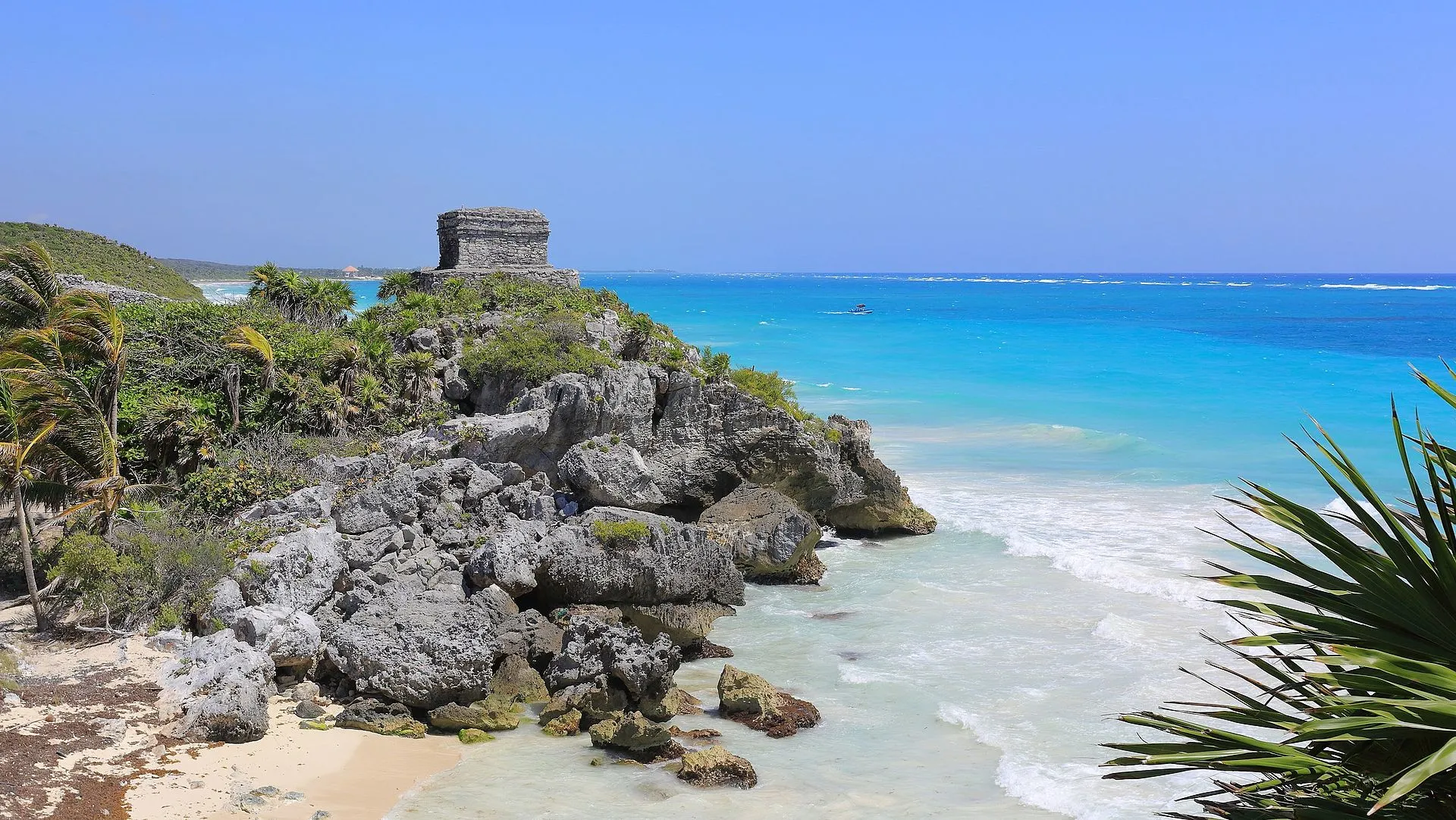
It rises on the brink of a high, broken, precipitous cliff, commanding a magnificent ocean view, and a picturesque line of coast, being itself visible from a great distance at sea.
Systematic archaeology followed slowly. The Carnegie Institution worked the coast from 1916 to 1922, and in 1924 Samuel Lothrop drew the first scientific map of the site; later investigators — Miguel Ángel Fernández, William Sanders, and Arthur G. Miller — filled in the chronology through the 20th century. The structures they documented are what you walk among today:
- El Castillo: The iconic clifftop watchtower, its 12-meter perch doubling as a defensive lookout and a beacon for canoes threading the only gap in the Mesoamerican Barrier Reef.
- Temple of the Frescoes: A two-story shrine whose interior murals — among the best-preserved on the Maya coast — depict deities and astronomical cycles; its facade niches hold figures of the diving god, and scholars think the building doubled as a solar observatory.
- The city wall: A limestone rampart averaging 3-5 meters tall and up to 8 meters thick, running some 400 meters along the sea-parallel side with shorter 170-meter returns, pierced by five narrow gateways and corner watchtowers — the "wall" that gave Tulum its modern name.
- Wildlife: Spiny-tailed iguanas bask on nearly every stone, utterly indifferent to the crowds.
Key Artifacts
The Temple of the Frescoes holds Tulum's greatest treasures: painted stucco reliefs of the diving god — a figure shown plunging headfirst that recurs across the city's facades and may personify the setting sun, the bee god Ah Muzen Cab, or the planet Venus, whose cycle the Maya tracked obsessively. Carved stucco masks of Itzamná, the supreme creator deity, watch from the temple's corners. Excavations have turned up jade beads, obsidian blades sourced from highland Guatemala, and copper bells cast in central Mexico, confirming Tulum's role as a linchpin of the Mesoamerican maritime trade network — the coastal counterpart to inland powers such as Chichén Itzá.
Two enduring puzzles keep archaeologists arguing. The first is Stela 1, carved with a Long Count date of 564 CE yet standing in a city built six centuries later — almost certainly hauled from an older site and reused, though no one is sure why. The second lies beneath the ruins entirely: in 2016, divers mapping the flooded cave system below the cliffs recovered the skeleton of a young woman who may have died more than 9,900 years ago, long before the Maya, hinting that people were drawn to Tulum's cenotes at the very end of the last Ice Age.
When to Visit
Open daily: 8:00 AM - 5:00 PM (last entry 4:30 PM). Best time to visit: 8:00 AM sharp — you will have the ruins nearly to yourself for the first hour. Avoid: 10:00 AM - 1:00 PM when cruise ship excursions and tour buses arrive simultaneously. Rainy season note: June through October brings afternoon showers; mornings are usually clear. Mind the two Tulums: the zona arqueológica sits a few kilometers north of Tulum Pueblo (town), so confirm your driver or colectivo is bound for the ruins, not the beach hotel strip.
Admission and Costs
Entry fee: MX$95 (~$5) — one of the most affordable major sites in Mexico; Mexican nationals and residents enter free on Sundays (bring ID). Parking: MX$120 at the official lot; a short walk or MX$20 shuttle ride to the entrance. On-site guide: MX$800-1,200 for a group tour (45-60 minutes). Guided day trip from Cancún: MX$1,800-3,000 per person, usually including a cenote stop. Private tour with transport: MX$4,000-6,500 for up to 4 people.
The Case for a Guide
Tulum's clifftop ruins are dramatic enough on their own, but the astronomical engineering, sacred cenote, and Maya maritime economy beneath the picturesque surface require a guide to become legible — not least because several key areas are accessible only with official guide permits.
- El Castillo as active lighthouse: The tower's two small windows face the sea at specific angles that, when lit from inside at night, created a navigational marker for Maya trading canoes approaching the only break in the Mesoamerican Barrier Reef; a guide demonstrates the window alignment and explains the reef geography this lighthouse exploited.
- Observation tower astronomical function: The Temple of the Frescoes' upper niche contains a stucco figure of the Descending God positioned to catch specific sunrise angles during equinoxes; a guide explains the Maya calendar system the building was designed to calibrate and how the priests used it to coordinate planting cycles.
- The freshwater cenote by the north wall: A small cenote near the northern rampart supplied the city with drinking water and was one reason this stretch of cliff was chosen; guides explain its practical role on a coast with no surface rivers, and how the Maya read such water-filled sinkholes as openings to the underworld and sites of offerings to the rain deity.
- Late Postclassic Maya resilience: Tulum remained occupied until the Spanish arrival in the 16th century, long after most inland sites collapsed; a guide explains why coastal trading cities survived the earlier Maya decline that devastated inland polities, and what the archaeological evidence suggests about the economic resilience of maritime communities.
- Restricted area access: Several sections including the interior of El Castillo and close approach to the painted fresco walls require an officially licensed guide present; self-touring visitors are physically kept out of these zones by rope barriers that guides can pass with their group.
Tips for Visitors
Arrive at 8 AM opening: The difference between 8 AM and 10 AM is dramatic — early birds get photos without hundreds of people in frame. Bring your swimsuit: The beach below the ruins is one of the most beautiful in the Riviera Maya, and you will want to swim. Combine with a cenote: Gran Cenote and Cenote Calavera are both within 15 minutes of Tulum. Wear comfortable shoes: The terrain is rough coral limestone — flip-flops are a recipe for twisted ankles. Sunscreen and water: Shade is minimal on the cliff paths. ADO bus option: Comfortable, air-conditioned ADO buses run directly from Cancún to Tulum town for about MX$200 each way.
Frequently Asked Questions
What months are ideal for visiting Tulum?
February through April is peak season for good reason: rainfall is minimal, Caribbean waters are calm and warm, and the clifftop ruins bask in consistent sunshine perfect for photography. September is the least favorable month due to heavy rains and the peak of hurricane season. The shoulder months of November and December offer a nice balance of drier weather, smaller crowds, and lower accommodation prices in the surrounding area.
What time of day is best for touring Tulum?
Open daily: 8:00 AM - 5:00 PM (last entry 4:30 PM). Best time to visit: 8:00 AM sharp — you will have the ruins nearly to yourself for the first hour. Avoid: 10:00 AM - 1:00 PM when cruise ship excursions and tour buses arrive simultaneously.
What is the entrance fee for Tulum?
Entry fee: MX$95 (~$5) — one of the most affordable major sites in Mexico. Parking: MX$120 at the official lot; a short walk or MX$20 shuttle ride to the entrance. On-site guide: MX$800-1,200 for a group tour (45-60 minutes).
Is a guide recommended for visiting Tulum?
Guides explain how Tulum functioned as a walled trading port from 1200 to 1521 CE, decode the diving god reliefs and Itzamna masks on the Temple of the Frescoes, and reveal how the site's alignment to the winter solstice sunrise demonstrates the same astronomical sophistication found at Chichen Itza.
What was Tulum's original Maya name?
The Maya called the city Zamá, usually translated as "City of Dawn" or "sunrise" — a fitting name for a settlement on an east-facing cliff that catches the first light breaking over the Caribbean. "Tulum," Yucatec Maya for "wall" or "fence," is a later name that refers to the defensive rampart enclosing the site on its three landward sides.
Who rediscovered the Tulum ruins?
Europeans first recorded Tulum in 1518, when Juan Díaz of Juan de Grijalva's expedition spotted the walled town from the sea. The ruins were introduced to the wider world in 1843 by explorer John Lloyd Stephens and artist Frederick Catherwood, whose book Incidents of Travel in Yucatán published the first detailed survey and drawings of El Castillo. Systematic mapping followed with Samuel Lothrop's 1924 Carnegie Institution study.